

 English
 Spanish
 Catalan
 French
 Italian
 Hasta ahora las aeronaves teledirigidas, técnicamente denominadas ROV (siglas de ‘vehículo operado remotamente’) o AUV (vehículo submarino autónomo), eran el patrimonio casi exclusivo de los centros de investigación y se fabricaban individualmente y bajo especificaciones "a la carta". Dentro de poco los interesados en explorar ríos, lagos y mares desde dentro y trabajar e investigar en estos entornos sumergidos, dispondrán de la primera generación de drones acuáticos producidos en serie y para una amplia gama de usuarios. La empresa OpenROV de Berkeley, California (EE.UU.) ha lanzado el 'Trident', un dron subacuático de bajo coste y para todo tipo de usuarios. Según sus diseñadores, esta máquina aspira a democratizar la exploración del océano. Es lo suficientemente simple como para conectarla y operar al instante y, al mismo tiempo, lo bastante avanzada como para utilizarse en investigaciones científicas. Volando bajo el agua [caption id="attachment_681" align="alignnone" width="1000"]  Sumergible 'Trident' (foto: OpenROV (EE.UU.))[/caption] El ‘Trident’ pesa menos de tres kilogramos, cabe dentro de una mochila o debajo de un asiento de avión, puede sumergirse hasta 100 metros de profundidad, y alcanza una velocidad de 2 metros por segundo. Este vehículo tiene una forma hidrodinámica que le permite moverse de forma rápida y precisa bajo el agua, mientras envía las imágenes de vídeo que capta en directo a la superficie, a través de un delgado cable de decenas de metros de largo, que tiene una flotabilidad neutra (no se hunde ni sale a la superficie), señalan desde la compañía californiana. [caption id="attachment_683" align="alignnone" width="1000"]
  El 'Trident' en acción (foto: OpenROV (EE.UU.))[/caption] Este aparato, similar a una caja rectangular aplanada, puede ser controlado a distancia por el usuario desde la superficie por medio de un ordenador portátil, un teléfono inteligente o una tableta electrónica. “Las aplicaciones potenciales de “Trident” son numerosas e incluyen, desde proyectos de biología marina y la localización y valoración de sitios de buceo, hasta las inspecciones de botes y barcos y la exploración submarina”, indican Stackpole y Lang. A 6 km bajo la superficie del mar Los vehículos submarinos autónomos son esenciales para tareas tales como la exploración de los fondos marinos en busca de petróleo o minerales, según los investigadores del Instituto Fraunhofer de Optrónica, Tecnologías de Sistemas y Explotación de la Imagen (IOSB) en Ilmenau y en Karlsruhe, Alemania. [caption id="attachment_685" align="alignnone" width="1000"]
  'Dedave' (foto: Fraunhofer IOSB-AST-Alemania)[/caption] Para satisfacer esta demanda, los investigadores del IOSB han diseñado un vehículo submarino autónomo (AUV) llamado ‘Dedave’, y que puede ser fabricado en grandes cantidades. El sumergible navega bajo el agua de forma autónoma, sin cables o correas de conexión física con la embarcación. Un punto fuerte de este vehículo submarino de 3,5 metros de largo, menos de 700 kilogramos de peso y capaz de alcanzar 6.000 metros de profundidad y los 4 nudos de velocidad, es que ocupa poco espacio y un contenedor de transporte estándar puede alojar cuatro de estos sumergibles, de acuerdo al IOSB. Ricardo Segura | EFE

 X
X 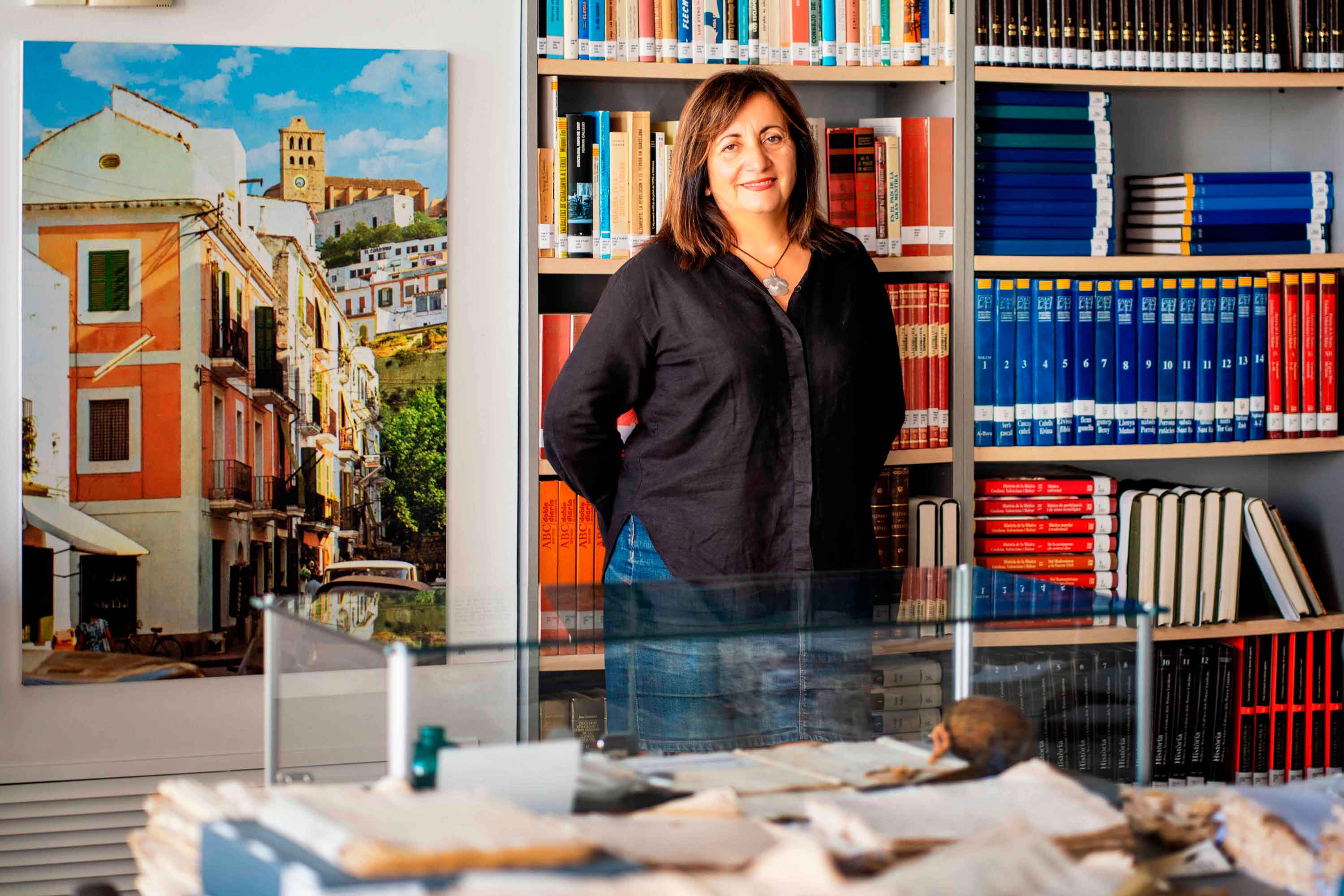
Historias del mar
Fanny Tur: «Baleària ya forma parte de la historia del transporte marítimo»
Ibicenca, activista medioambiental, historiadora, directora del archivo histórico de Eivissa… Fanny Tur Riera desempeñó, entre otros cargos públicos, el de consellera de Cultura del Govern Balear entre 2017 y 2019. Desde esta perspectiva, su análisis con visión histórica cobra valor: «Baleària ya forma parte de la historia del transporte marítimo de las Balears y del Mediterráneo», afirma antes de reflexionar sobre lo que supuso la irrupción de la naviera, ya que «los monopolios nunca son buenos y diversificar la oferta siempre tiene que beneficiar al usuario». En clave cultural y de género, esta historiadora destaca de la naviera Baleària cuestiones como «la atención en y al catalán, o poner nombres de mujer a algunos barcos, mostrando que la historia también la escribimos las mujeres». Desde la perspectiva ecologista, Tur Riera valora el compromiso de Baleària con la sostenibilidad partiendo de que «la actividad humana en general y el turismo y la gran movilidad en particular tienen unos efectos devastadores sobre el mar y el territorio». En este sentido, destaca, «todas las medidas que se pongan en práctica para minimizar los efectos de la masificación, como por ejemplo emplear energías renovables y colaborar con entidades ecologistas, ponen un grano de arena en una lucha que hace tiempo es imprescindible para la misma supervivencia». Pero si algo destaca de la aportación de Baleària esta exconsellera de Cultura del Govern Balear es el papel desempeñado por la Fundación Baleària, que ha hecho que «la creación pueda viajar a nuevos escenarios y no se quede en el lugar de origen. Para enriquecerse y crecer, el arte y la creación se tienen que mover mientras conservan sus raíces bien fuertes». Y ello, subraya, en combinación con la gestión de espacios culturales «en diferentes lugares —lo que desde la Fundación Baleària llaman las Llonges de la Cultura—, facilitando así que puedan acoger actividades, encuentros, investigación, muestras colectivas y creadores de todo el país para que se puedan encontrar y enriquecerse mutuamente» porque, reflexiona, «el arte y la investigación son trabajo propio, pero también son puesta en común y conocimiento mutuo». Creación cultural «En definitiva —asegura Fanny Tur— Baleària a través de su fundación ha hecho posible que la creación tenga movilidad, circule, se muestre en nuevos escenarios, porque así crece y encuentra nuevos paisajes… ha contribuido a la relación y el conocimiento mutuo entre creadores, facilitando que se encuentren, se conozcan y, en definitiva, que establezcanvínculos». En el caso de Balears, Fanny Tur considera que la de Baleària y de su fundación han sido una magnífica aportación favorecedora de la articulación social y cultural, además de subrayar la revitalización que ha supuesto la conexión, en todos los ámbitos, entre Dénia y Eivissa.
Read more

Historias del mar
De grumete a capitán. Vocabulario marítimo básico (I)
¿Dónde queda babor y estribor? ¿Cuál es la diferencia entre manga y eslora? Seguro que has oído una y mil veces términos como estos pero todavía te siguen generando dudas cuando subes a bordo de un ferri. No te preocupes, hemos preparado un glosario básico de léxico marítimo para que alimentes tu vocabulario y disfrutes todavía más de tu experiencia de viaje. Deja atrás tus titubeos de grumete y presume de hablar con la propiedad de un capitán. ¿Empezamos? PARTES DEL FERRI CASCO. El cuerpo del buque. La estructura ‘en neto’, sin máquinas, mástiles ni elementos accesorios para la navegación. CUBIERTA: Cada uno de los pisos de una embarcación. Forman la estructura que permiten un espacio habitable para la tripulación y el pasaje. Los barcos tienen varias cubiertas, tanto para la bodega -donde se ubica la carga y los vehículos- como para las zonas de pasajeros –con salones, áreas de butacas, restaurantes, etc.- siendo la principal la superior. QUILLA: Es la columna vertebral del barco. La pieza de hierro que va de popa a proa por la parte inferior del barco y en que se asienta toda su armazón.Constituye el principal refuerzo estructural de la embarcación, en el que se encastan los demás y sobre el que descargan su peso. [caption id="attachment_1776" align="aligncenter" width="800"] Corte transversal del ferri Martín i Soler de Baleària, donde se diferencia el casco, la quilla y las diferentes cubiertas.[/caption] VOLUMEN Y DIMENSIONES ESLORA: La longitud de la embarcación. O dicho de otra manera, la distancia de punta a punta de la estructura del buque. MANGA: La anchura (máxima) de un buque. PUNTAL. La altura de la bodega de la nave desde la quilla hasta el extremo de la cubierta superior. DESPLAZAMIENTO: El volumen de agua que desplaza la parte sumergida del barco. Es decir… el peso del barco. Ahora se entiende mejor ¿verdad?. POSICIÓN EN EL BARCO PROA y POPA. La proa es la parte delantera del barco. Tiene forma de cuña para que el buque pueda "cortar el agua”. Por el contrario, la popa es la parte posterior de la estructura del buque. BABOR y ESTRIBOR. Por babor se considera el lado izquierdo de un buque, mirando desde atrás hacia delante, esto es de popa a proa. Estribor es la banda o lado derecho de un buque, mirando desde atrás hacia delante, esto es de popa a proa. OBRA VIVA y MUERTA. La viva es la parte del casco bajo el agua. Es decir, desde la quilla a la línea de flotación a máxima carga. La muerta, la parte del casco que sobresale del mar MANIOBRAS ARRIAR. Aflojar o soltar un cabo (las cuerdas de a bordo). También se utilizan los términos LASCAR (aflojar) y LARGAR (soltar). Una advertencia: a bordo de los barcos sólo hay una cuerda, la del cronómetro. Las demás se llaman CABOS (y en los barcos grandes ESTACHAS). VIRAR. Lo contrario de arriar, es decir COBRAR o recuperar un cabo o el ancla, cuando el buque se encuentra fondeado. Por cierto, la maniobra de virar es propia de buques de vela y no tanto de ferris. ATRACAR. Operación para ubicar el buque en el lugar previsto del muelle. Concluye en el momento en que la embarcación AMARRA (o ata firmemente) el último cabo al NORAY o bolardo del muelle. Por cierto, la maniobra contraria a ATRACAR ser llama DESATRACAR. Lógico ¿no? BARLOVENTEAR. Maniobrar aprovechando la fuerza viento (a favor o en contra) para que el impulso sea lo más favorable a la embarcación. Por ejemplo, en el caso de una operación de atraque. CAPEAR. Se trata de una maniobra de navegación con mal tiempo. Consiste en tratar de mantener la proa al viento y con poca velocidad, para conseguir una trayectoria controlada y segura hasta que amaine el temporal. FONDEAR. Posicionar el buque en aguas establecidas para el anclaje. Y hasta aquí, por esta vez. Si quieres seguir aprendiendo sobre ferris y transporte marítimo, sigue navegando con el blog Entreolas y no te pierdas nuestra próxima entrega de vocabulario.
Read more