

 English
 Spanish
 Catalan
 French
 Italian
 La diversidad de lugares para el ocio y el turismo que ofrece la provincia de Granada es enorme. En ella destaca el espectacular Parque Nacional de Sierra Nevada, con nieve durante muchos meses al año, pero también se pueden encontrar zonas de playas maravillosas o de bosques, que la conforman como una de las más bellas de Europa. La provincia de Granada es una de las más bonitas no sólo de Andalucía, sino también de España y de Europa. La variedad que posee nos lleva desde las playas de fina arena bañadas por el cálido mediterráneo hasta los picos más altos de la Península Ibérica. Pero Granada tiene mucho más y aquí mostramos las peculiaridades de algunos de sus mejores Parques Naturales. [gallery columns="2" link="none" size="large" ids="725,726"] La Sierra de Baza, limitada por la provincia de Almería, posee una geografía espectacular por la altura de sus cimas que se sitúan entre los 1.200 y los 2.200 metros. De difícil acceso, alberga una vegetación baja, capaz de soportar las extremas temperaturas y los fuertes vientos. Entre las pendientes de sus laderas se expande un parque solitario donde el silencio sólo es roto por las grandes rapaces que allí anidan. [caption id="attachment_728" align="aligncenter" width="1000"]  Paisaje estepario típico de Baza[/caption] Los pequeños arroyos que salpican el paisaje ocasionan un flujo de agua subterráneo que se transforma entre las rocas en manantiales y fuentes. En su viaje, estas aguas van a parar al río Baza, que se encuentra en la cuenca del Guadalquivir. Sierra de Huétor, el descanso de los granadinos El Parque Natural de la Sierra de Huétor se encuentra en el centro y noroeste de la provincia de Granada. La altura de las montañas en esta sierra se sitúa entre los 1.100 y los 1.900 metros de altitud y su paisaje está compuesto por estrechos barrancos, tajos, calares y arroyos entre los que crece una abundante vegetación. Por su proximidad a la ciudad de Granada hace que sea uno de los Parques más visitados y se haya convertido en enclave tradicional. Un gran bosque cubre la mayor parte de su superficie, formado por pinares, así como encinas, quejigales, robles y arces. Sierra Castril, dibujada por el agua Al norte de la provincia de Granada se encuentra la Sierra de Castril y dentro del término municipal del mismo nombre, como del mismo nombre es el río que la atraviesa. Es precisamente el río Castril el que dibuja su orografía con abundantes simas, grutas y galerías, que son de gran atractivo para los interesados en la geología y la espeleología. [caption id="attachment_731" align="alignnone" width="1000"]
  Parque Natural de la Sierra de Castril[/caption] El Castril discurre por un profundo valle que en algunos tramos se transforma en estrechísimas gargantas, con laderas de hasta 400 metros de desnivel, que concluyen en saltos de agua de agua de extraordinaria belleza. También la formación de cuevas es una de las atracciones de la Sierra. Simas en las que se pueden encontrar salas que muestran estalactitas y estalagmitas muy vistosas y galerías de gran belleza. Entre ellas, la “Cueva del Muerto” o la “Cueva de don Fernando” son dos de las más importantes en la zona. Tejeda y Almijara, aires moriscos Las Sierras Tejeda y Almijara constituyen un impresionante macizo montañoso que actúa como barrera natural entre las provincias de Málaga y Granada. El nombre de Tejeda procede de la cantidad de tejos que había antiguamente en esta sierra, mientras que Almijara procede de la palabra árabe “almijar”, que significa escurridero, en alusión a la rapidez con la que las aguas descienden por esta sierra para llegar al mar. [caption id="attachment_727" align="alignnone" width="1000"]
  Pantano de Béznar[/caption] Los parajes de estas sierras se han mantenido en muy buen estado de conservación, así como sus pueblos en los que todavía permanece casi intacta la arquitectura tradicional de aires mudéjares y moriscos, con relumbrantes fachadas de cal, estrechas escalinatas y altos torreones. Entre estos pueblos cabe destacar por su tipismo Alhama de Granada, Salares y Frigiliana. Isabel Martínez Pita | EFE

 X
X 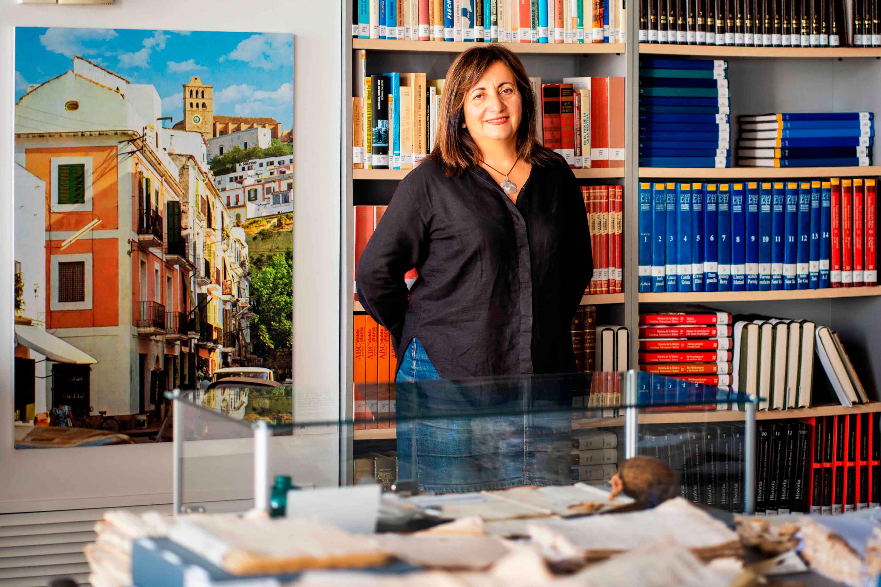
Historias del mar
Fanny Tur: «Baleària ya forma parte de la historia del transporte marítimo»
Ibicenca, activista medioambiental, historiadora, directora del archivo histórico de Eivissa… Fanny Tur Riera desempeñó, entre otros cargos públicos, el de consellera de Cultura del Govern Balear entre 2017 y 2019. Desde esta perspectiva, su análisis con visión histórica cobra valor: «Baleària ya forma parte de la historia del transporte marítimo de las Balears y del Mediterráneo», afirma antes de reflexionar sobre lo que supuso la irrupción de la naviera, ya que «los monopolios nunca son buenos y diversificar la oferta siempre tiene que beneficiar al usuario». En clave cultural y de género, esta historiadora destaca de la naviera Baleària cuestiones como «la atención en y al catalán, o poner nombres de mujer a algunos barcos, mostrando que la historia también la escribimos las mujeres». Desde la perspectiva ecologista, Tur Riera valora el compromiso de Baleària con la sostenibilidad partiendo de que «la actividad humana en general y el turismo y la gran movilidad en particular tienen unos efectos devastadores sobre el mar y el territorio». En este sentido, destaca, «todas las medidas que se pongan en práctica para minimizar los efectos de la masificación, como por ejemplo emplear energías renovables y colaborar con entidades ecologistas, ponen un grano de arena en una lucha que hace tiempo es imprescindible para la misma supervivencia». Pero si algo destaca de la aportación de Baleària esta exconsellera de Cultura del Govern Balear es el papel desempeñado por la Fundación Baleària, que ha hecho que «la creación pueda viajar a nuevos escenarios y no se quede en el lugar de origen. Para enriquecerse y crecer, el arte y la creación se tienen que mover mientras conservan sus raíces bien fuertes». Y ello, subraya, en combinación con la gestión de espacios culturales «en diferentes lugares —lo que desde la Fundación Baleària llaman las Llonges de la Cultura—, facilitando así que puedan acoger actividades, encuentros, investigación, muestras colectivas y creadores de todo el país para que se puedan encontrar y enriquecerse mutuamente» porque, reflexiona, «el arte y la investigación son trabajo propio, pero también son puesta en común y conocimiento mutuo». Creación cultural «En definitiva —asegura Fanny Tur— Baleària a través de su fundación ha hecho posible que la creación tenga movilidad, circule, se muestre en nuevos escenarios, porque así crece y encuentra nuevos paisajes… ha contribuido a la relación y el conocimiento mutuo entre creadores, facilitando que se encuentren, se conozcan y, en definitiva, que establezcanvínculos». En el caso de Balears, Fanny Tur considera que la de Baleària y de su fundación han sido una magnífica aportación favorecedora de la articulación social y cultural, además de subrayar la revitalización que ha supuesto la conexión, en todos los ámbitos, entre Dénia y Eivissa.
Read more

Historias del mar
De grumete a capitán. Vocabulario marítimo básico (I)
¿Dónde queda babor y estribor? ¿Cuál es la diferencia entre manga y eslora? Seguro que has oído una y mil veces términos como estos pero todavía te siguen generando dudas cuando subes a bordo de un ferri. No te preocupes, hemos preparado un glosario básico de léxico marítimo para que alimentes tu vocabulario y disfrutes todavía más de tu experiencia de viaje. Deja atrás tus titubeos de grumete y presume de hablar con la propiedad de un capitán. ¿Empezamos? PARTES DEL FERRI CASCO. El cuerpo del buque. La estructura ‘en neto’, sin máquinas, mástiles ni elementos accesorios para la navegación. CUBIERTA: Cada uno de los pisos de una embarcación. Forman la estructura que permiten un espacio habitable para la tripulación y el pasaje. Los barcos tienen varias cubiertas, tanto para la bodega -donde se ubica la carga y los vehículos- como para las zonas de pasajeros –con salones, áreas de butacas, restaurantes, etc.- siendo la principal la superior. QUILLA: Es la columna vertebral del barco. La pieza de hierro que va de popa a proa por la parte inferior del barco y en que se asienta toda su armazón.Constituye el principal refuerzo estructural de la embarcación, en el que se encastan los demás y sobre el que descargan su peso. [caption id="attachment_1776" align="aligncenter" width="800"] Corte transversal del ferri Martín i Soler de Baleària, donde se diferencia el casco, la quilla y las diferentes cubiertas.[/caption] VOLUMEN Y DIMENSIONES ESLORA: La longitud de la embarcación. O dicho de otra manera, la distancia de punta a punta de la estructura del buque. MANGA: La anchura (máxima) de un buque. PUNTAL. La altura de la bodega de la nave desde la quilla hasta el extremo de la cubierta superior. DESPLAZAMIENTO: El volumen de agua que desplaza la parte sumergida del barco. Es decir… el peso del barco. Ahora se entiende mejor ¿verdad?. POSICIÓN EN EL BARCO PROA y POPA. La proa es la parte delantera del barco. Tiene forma de cuña para que el buque pueda "cortar el agua”. Por el contrario, la popa es la parte posterior de la estructura del buque. BABOR y ESTRIBOR. Por babor se considera el lado izquierdo de un buque, mirando desde atrás hacia delante, esto es de popa a proa. Estribor es la banda o lado derecho de un buque, mirando desde atrás hacia delante, esto es de popa a proa. OBRA VIVA y MUERTA. La viva es la parte del casco bajo el agua. Es decir, desde la quilla a la línea de flotación a máxima carga. La muerta, la parte del casco que sobresale del mar MANIOBRAS ARRIAR. Aflojar o soltar un cabo (las cuerdas de a bordo). También se utilizan los términos LASCAR (aflojar) y LARGAR (soltar). Una advertencia: a bordo de los barcos sólo hay una cuerda, la del cronómetro. Las demás se llaman CABOS (y en los barcos grandes ESTACHAS). VIRAR. Lo contrario de arriar, es decir COBRAR o recuperar un cabo o el ancla, cuando el buque se encuentra fondeado. Por cierto, la maniobra de virar es propia de buques de vela y no tanto de ferris. ATRACAR. Operación para ubicar el buque en el lugar previsto del muelle. Concluye en el momento en que la embarcación AMARRA (o ata firmemente) el último cabo al NORAY o bolardo del muelle. Por cierto, la maniobra contraria a ATRACAR ser llama DESATRACAR. Lógico ¿no? BARLOVENTEAR. Maniobrar aprovechando la fuerza viento (a favor o en contra) para que el impulso sea lo más favorable a la embarcación. Por ejemplo, en el caso de una operación de atraque. CAPEAR. Se trata de una maniobra de navegación con mal tiempo. Consiste en tratar de mantener la proa al viento y con poca velocidad, para conseguir una trayectoria controlada y segura hasta que amaine el temporal. FONDEAR. Posicionar el buque en aguas establecidas para el anclaje. Y hasta aquí, por esta vez. Si quieres seguir aprendiendo sobre ferris y transporte marítimo, sigue navegando con el blog Entreolas y no te pierdas nuestra próxima entrega de vocabulario.
Read more