

 English
 Spanish
 Catalan
 French
 Italian
 En términos de navegación, podemos definir una maniobra como el arte y la ciencia de mover buques. Para realizar esta tarea hay dos factores fundamentales que influyen en la misma. Por un lado, aquellos que no podemos controlar y que dependen de la naturaleza como son el viento, la corriente, el oleaje o la inercia. Por otro, están aquellos factores que sí podemos controlar con la ayuda de los denominados medios auxiliares de maniobra que son los timones, hélices, hélices de maniobra, cabos, anclas, remolcadores, etc. Gracias al conocimiento y el control de todos estos factores, y sobre todo a la práctica, se pueden realizar maniobras con seguridad con todo tipo de buques, todos los días y en todos los puertos del mundo. [caption id="attachment_1080" align="aligncenter" width="1000"]  El capitán del buque Abel Matutes[/caption] Pero, ¿cómo se realiza una maniobra? Empezamos con la maniobra de atraque, que sería algo similar a aparcar un camión en marcha y sin frenos, mientras alguien te mueve la carretera. Parece complicado pero tiene su técnica. Para explicarlo vamos a poner como ejemplo la maniobra del ferry Abel Matutes de Baleària en su atraque habitual en el Muelle Adosado del puerto de Barcelona. En este caso nuestro camión pasa a tener una longitud similar a la de dos campos de fútbol juntos y un peso de unas 30.000 toneladas. Cuenta además con dos hélices principales, dos timones y dos hélices de maniobra, que son unas hélices más pequeñas situadas en la proa que sirven para acercar o separar la parte delantera del buque del muelle. Cabe remarcar que este ferry es capaz de generar una potencia total de 21.000Kw, suficiente para dar suministro eléctrico a un pueblo pequeño de unas 4.000 viviendas. ¿Increíble, verdad? [caption id="attachment_1079" align="alignnone" width="1000"]
  Puente de mando del buque Abel Matutes[/caption] Las maniobras de entrada suelen comenzar con el buque navegando a toda máquina cuando se encuentra a 2 millas (3,7km 1 milla=1852m) de la boya de recalada del puerto, que indica dónde empieza el canal de acceso al puerto. A esta distancia avisamos primero por radio al Control de Tráfico de Barcelona para informar de nuestra situación y luego al Servicio de Información e Instrucciones Generales a Buques (SGIIB), gestionado por la Corporación de Prácticos del puerto, que es quien autoriza la entrada y nos informa de las condiciones de mar y viento en el interior del puerto. Tras estos avisos, procedemos a la entrada al puerto reduciendo la velocidad paulatinamente, primero a unos 14 nudos (25km/h) para posteriormente bajar a 7 nudos (12,5km/h), que es la velocidad de tránsito hasta nuestro atraque. Seguimos navegando por el interior del puerto y, una vez llegados al muelle, empezamos el reviro sobre babor, es decir, el giro sobre nuestro centro. Para realizar esto ponemos la máquina de Estribor avante y la máquina de Babor atrás (par de fuerzas). Para ayudar a este movimiento de rotación, y reducir la deriva y abatimiento, nos ayudamos de las hélices de maniobra, y aumentando o disminuyendo su intensidad, podemos realizar el movimiento de giro y contrarrestar los posibles efectos del viento o corriente. En términos náuticos a este movimiento se le llama ciaboga. Una vez claro el reviro, daremos marcha atrás dejando ver la esquina de nuestro tacón, que es la porción del muelle donde se apoyan las rampas. [gallery columns="2" size="full" ids="1082,1081"] Una vez que el buque empieza a ir hacia atrás empezamos a realizar el traslado lateral hacia el muelle. Para ello damos avante con la máquina que está por la banda del muelle y dejamos la otra como estaba atrás (par de fuerzas). Con ayuda de las hélices de maniobra vamos colocando el buque paralelo al muelle y controlando la velocidad, que en la posición de atraque ha de ser cero o prácticamente nula, y ajustando ésta en función de la distancia y de una marca de referencia que tenemos pintada en el muelle, que nos indica dónde debe quedar la posición del puente de mando. Tras esta laboriosa maniobra, atracamos el buque y damos los cabos ajustando con estos la posición del mismo al centímetro. [gallery columns="1" size="full" link="none" ids="1083"] La maniobra de salida tiene un procedimiento similar, aunque en sentido contrario. Una vez autorizada la salida por el SGIIB, largamos los cabos y damos avante con la máquina contraria al muelle. Una vez vencida la inercia, y cuando el buque empieza a moverse hacia delante, utilizaremos las hélices de maniobra en sentido inverso para despegar la proa del muelle y damos atrás con la máquina de la banda del muelle ayudando a separar la popa. Una vez salidos del muelle paramos las hélices de maniobra, damos avante con las dos máquinas y entramos por el canal por donde entramos directos hacia la salida del puerto. ¡Y avante toda! Óscar M. Millares Ortega | Capitán Abel Matutes

 X
X 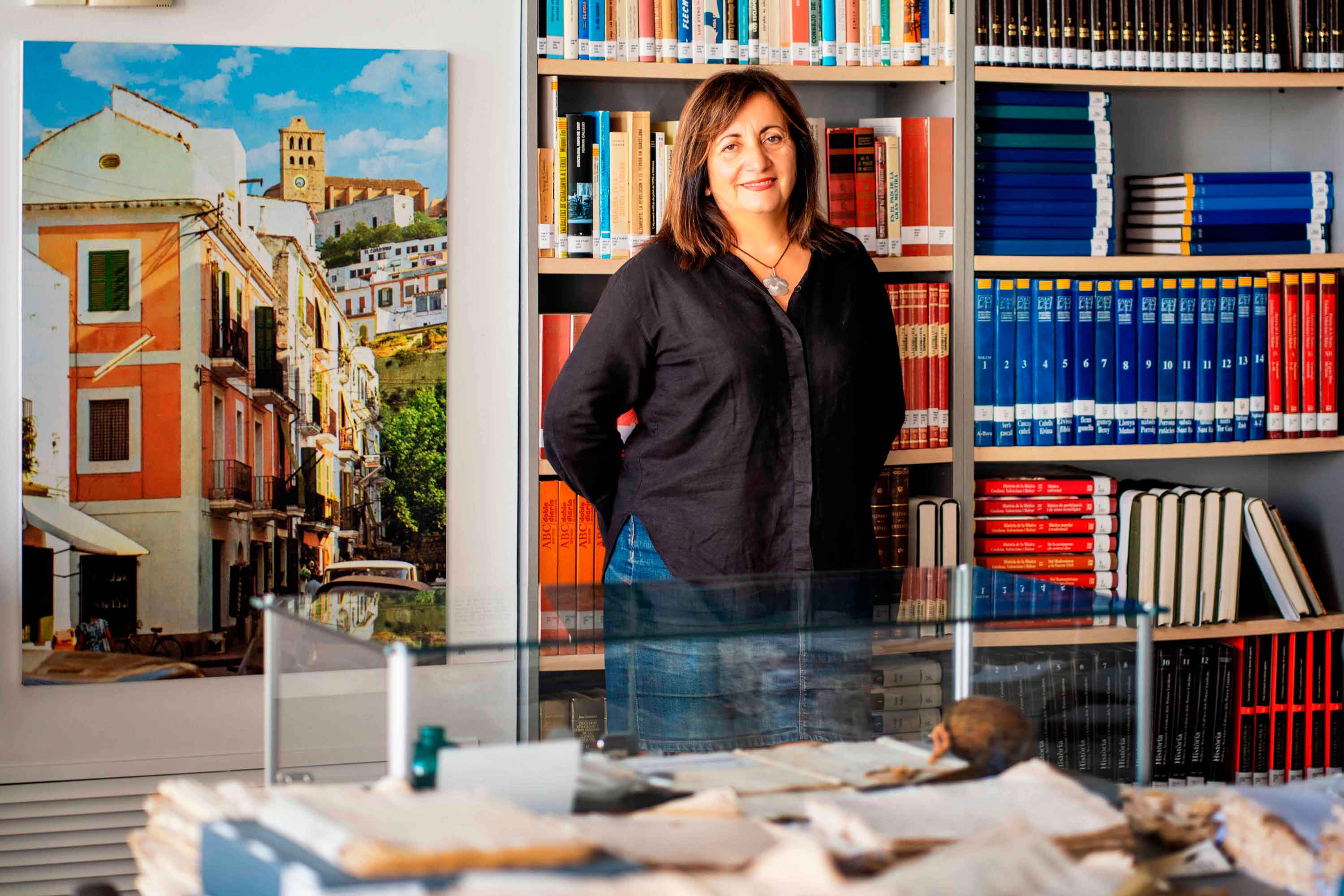
Historias del mar
Fanny Tur: «Baleària ya forma parte de la historia del transporte marítimo»
Ibicenca, activista medioambiental, historiadora, directora del archivo histórico de Eivissa… Fanny Tur Riera desempeñó, entre otros cargos públicos, el de consellera de Cultura del Govern Balear entre 2017 y 2019. Desde esta perspectiva, su análisis con visión histórica cobra valor: «Baleària ya forma parte de la historia del transporte marítimo de las Balears y del Mediterráneo», afirma antes de reflexionar sobre lo que supuso la irrupción de la naviera, ya que «los monopolios nunca son buenos y diversificar la oferta siempre tiene que beneficiar al usuario». En clave cultural y de género, esta historiadora destaca de la naviera Baleària cuestiones como «la atención en y al catalán, o poner nombres de mujer a algunos barcos, mostrando que la historia también la escribimos las mujeres». Desde la perspectiva ecologista, Tur Riera valora el compromiso de Baleària con la sostenibilidad partiendo de que «la actividad humana en general y el turismo y la gran movilidad en particular tienen unos efectos devastadores sobre el mar y el territorio». En este sentido, destaca, «todas las medidas que se pongan en práctica para minimizar los efectos de la masificación, como por ejemplo emplear energías renovables y colaborar con entidades ecologistas, ponen un grano de arena en una lucha que hace tiempo es imprescindible para la misma supervivencia». Pero si algo destaca de la aportación de Baleària esta exconsellera de Cultura del Govern Balear es el papel desempeñado por la Fundación Baleària, que ha hecho que «la creación pueda viajar a nuevos escenarios y no se quede en el lugar de origen. Para enriquecerse y crecer, el arte y la creación se tienen que mover mientras conservan sus raíces bien fuertes». Y ello, subraya, en combinación con la gestión de espacios culturales «en diferentes lugares —lo que desde la Fundación Baleària llaman las Llonges de la Cultura—, facilitando así que puedan acoger actividades, encuentros, investigación, muestras colectivas y creadores de todo el país para que se puedan encontrar y enriquecerse mutuamente» porque, reflexiona, «el arte y la investigación son trabajo propio, pero también son puesta en común y conocimiento mutuo». Creación cultural «En definitiva —asegura Fanny Tur— Baleària a través de su fundación ha hecho posible que la creación tenga movilidad, circule, se muestre en nuevos escenarios, porque así crece y encuentra nuevos paisajes… ha contribuido a la relación y el conocimiento mutuo entre creadores, facilitando que se encuentren, se conozcan y, en definitiva, que establezcanvínculos». En el caso de Balears, Fanny Tur considera que la de Baleària y de su fundación han sido una magnífica aportación favorecedora de la articulación social y cultural, además de subrayar la revitalización que ha supuesto la conexión, en todos los ámbitos, entre Dénia y Eivissa.
Read more

Historias del mar
De grumete a capitán. Vocabulario marítimo básico (I)
¿Dónde queda babor y estribor? ¿Cuál es la diferencia entre manga y eslora? Seguro que has oído una y mil veces términos como estos pero todavía te siguen generando dudas cuando subes a bordo de un ferri. No te preocupes, hemos preparado un glosario básico de léxico marítimo para que alimentes tu vocabulario y disfrutes todavía más de tu experiencia de viaje. Deja atrás tus titubeos de grumete y presume de hablar con la propiedad de un capitán. ¿Empezamos? PARTES DEL FERRI CASCO. El cuerpo del buque. La estructura ‘en neto’, sin máquinas, mástiles ni elementos accesorios para la navegación. CUBIERTA: Cada uno de los pisos de una embarcación. Forman la estructura que permiten un espacio habitable para la tripulación y el pasaje. Los barcos tienen varias cubiertas, tanto para la bodega -donde se ubica la carga y los vehículos- como para las zonas de pasajeros –con salones, áreas de butacas, restaurantes, etc.- siendo la principal la superior. QUILLA: Es la columna vertebral del barco. La pieza de hierro que va de popa a proa por la parte inferior del barco y en que se asienta toda su armazón.Constituye el principal refuerzo estructural de la embarcación, en el que se encastan los demás y sobre el que descargan su peso. [caption id="attachment_1776" align="aligncenter" width="800"] Corte transversal del ferri Martín i Soler de Baleària, donde se diferencia el casco, la quilla y las diferentes cubiertas.[/caption] VOLUMEN Y DIMENSIONES ESLORA: La longitud de la embarcación. O dicho de otra manera, la distancia de punta a punta de la estructura del buque. MANGA: La anchura (máxima) de un buque. PUNTAL. La altura de la bodega de la nave desde la quilla hasta el extremo de la cubierta superior. DESPLAZAMIENTO: El volumen de agua que desplaza la parte sumergida del barco. Es decir… el peso del barco. Ahora se entiende mejor ¿verdad?. POSICIÓN EN EL BARCO PROA y POPA. La proa es la parte delantera del barco. Tiene forma de cuña para que el buque pueda "cortar el agua”. Por el contrario, la popa es la parte posterior de la estructura del buque. BABOR y ESTRIBOR. Por babor se considera el lado izquierdo de un buque, mirando desde atrás hacia delante, esto es de popa a proa. Estribor es la banda o lado derecho de un buque, mirando desde atrás hacia delante, esto es de popa a proa. OBRA VIVA y MUERTA. La viva es la parte del casco bajo el agua. Es decir, desde la quilla a la línea de flotación a máxima carga. La muerta, la parte del casco que sobresale del mar MANIOBRAS ARRIAR. Aflojar o soltar un cabo (las cuerdas de a bordo). También se utilizan los términos LASCAR (aflojar) y LARGAR (soltar). Una advertencia: a bordo de los barcos sólo hay una cuerda, la del cronómetro. Las demás se llaman CABOS (y en los barcos grandes ESTACHAS). VIRAR. Lo contrario de arriar, es decir COBRAR o recuperar un cabo o el ancla, cuando el buque se encuentra fondeado. Por cierto, la maniobra de virar es propia de buques de vela y no tanto de ferris. ATRACAR. Operación para ubicar el buque en el lugar previsto del muelle. Concluye en el momento en que la embarcación AMARRA (o ata firmemente) el último cabo al NORAY o bolardo del muelle. Por cierto, la maniobra contraria a ATRACAR ser llama DESATRACAR. Lógico ¿no? BARLOVENTEAR. Maniobrar aprovechando la fuerza viento (a favor o en contra) para que el impulso sea lo más favorable a la embarcación. Por ejemplo, en el caso de una operación de atraque. CAPEAR. Se trata de una maniobra de navegación con mal tiempo. Consiste en tratar de mantener la proa al viento y con poca velocidad, para conseguir una trayectoria controlada y segura hasta que amaine el temporal. FONDEAR. Posicionar el buque en aguas establecidas para el anclaje. Y hasta aquí, por esta vez. Si quieres seguir aprendiendo sobre ferris y transporte marítimo, sigue navegando con el blog Entreolas y no te pierdas nuestra próxima entrega de vocabulario.
Read more