

 English
 Spanish
 Catalan
 French
 Italian
 Dénia es uno de los destinos más conocidos del norte de la Costa Blanca por su exquisita gastronomía, el soberbio macizo rocoso del Montgó con el eterno mar de fondo o la belleza de sus playas. Pero muchos desconocen los tesoros que la ciudad alberga, discreta y silenciosamente, en sus luminosos fondos marinos. Son 20 kilómetros de litoral cargados de historia que nos hablan de la importancia del lugar para los comerciantes focenses, griegos y romanos, de cuya presencia aún aparecen de vez en cuando vestigios en forma de ánforas o anclas. El puerto era un seguro refugio para las naves mientras que el Montgó se erigía como excelente atalaya desde la que prevenirse del enemigo. Dos costas El litoral dianense nos ofrece dos tipos diferenciados de costa. La del norte, conocida como Les Marines, presenta extensas playas de fina arena muy adecuadas para el baño pero también con amplias posibilidades de buceo si accedemos en embarcación. En la vertiente sur, en la conocida área de Les Rotes, el litoral se vuelve rocoso para dar lugar a numerosas calas de acogedoras aguas y luminosos fondos bajo los espectaculares acantilados del Cap de Sant Antoni. Esta zona, de gran valor medioambiental, goza de la especial protección que le brinda su catalogación como Reserva Marina, y si bien podremos recorrer sus fondos libremente haciendo snorkel, necesitaremos permiso para sumergirnos con botellas. [gallery link="none" columns="2" size="full" ids="799,802"] En Dénia encontraremos fondos someros que van ganando, poco a poco, profundidad y donde es muy habitual disfrutar de la generosa transparencia de unas aguas que parece que nos invitan a asomarnos a unos paisajes tapizados por coloridas algas rojizas que contrastan con el intenso verde de la Posidonia oceanica, verdadero pulmón del mar que oxigena estas aguas en una proporción diez veces mayor que su equivalente de bosque tropical. Mil y un motivos en forma de veriles, praderas, restos arqueológicos, grutas… y mucha, mucha vida submarina harán inolvidable nuestra visita a las acogedoras aguas de Dénia, una tierra de litoral. Ruta de buceo: Fresquito Saliendo del puerto, cogemos la carretera de Les Rotes hasta el final, donde hay un párquing. Allí nos equipamos y bajamos hasta el mar, que forma una pequeña piscina natural de roca y agua transparente. Nos sumergimos en un fondo arenoso con lenguas de piedra, y seguimos siempre la pared que queda a nuestra derecha, con un rumbo de unos 60º. Es interesante detenerse en las cornisas que forma la pared, donde podremos observar pulpos, espirógrafos y tal vez alguna discreta morena. Llega un momento en que hay un estrechamiento con otra pared que surge de la izquierda. Continuamos buceando, rodeados de cardúmenes de luminosas salpas, y al cabo de unos minutos, en un fondo de unos 10 metros, comenzará a desaparecer la roca, que ahora se presentará en forma de piedras aisladas. Será el momento de la vuelta, aunque antes de llegar al estrechamiento nos pasaremos por unos instantes a esa pared (que ahora quedará a nuestra derecha) y encontraremos en la roca un arco que hace un bonito contraluz por el que podemos pasar. Tras ello volvemos a la pared de la inicial hasta llegar nuevamente al punto de partida. [gallery columns="2" link="none" size="full" ids="801,803"] Ruta de buceo: La Barra Saliendo en embarcación desde el puerto de Dénia, nos dirigiremos dirección Les Marines, aproximadamente a 1,5 millas del puerto, donde fondeamos a una profundidad de unos 7 metros, en un fondo rocoso en forma de lengua o barbada de gran longitud. La inmersión consiste en seguir la caída de las rocas, donde se forman cornisas y oquedades, para volver en sentido contrario, o bien realizar la inmersión como caribeña, esto es, sin fondear la embarcación, avanzar buceando para que al final del recorrido sea ésta la que acuda a nosotros. En los múltiples huecos y grietas podremos encontrar langostas, corvinas, pulpos… y no será extraña tampoco la presencia de escorpas y, ya en el arenal, alguna raya. En la parte superior de las rocas, tapizada por una abundante pradera de posidonia y algas rojas, son frecuentes los grupos de salpas y sargos. Rafa Martos | Instructor de buceo

 X
X 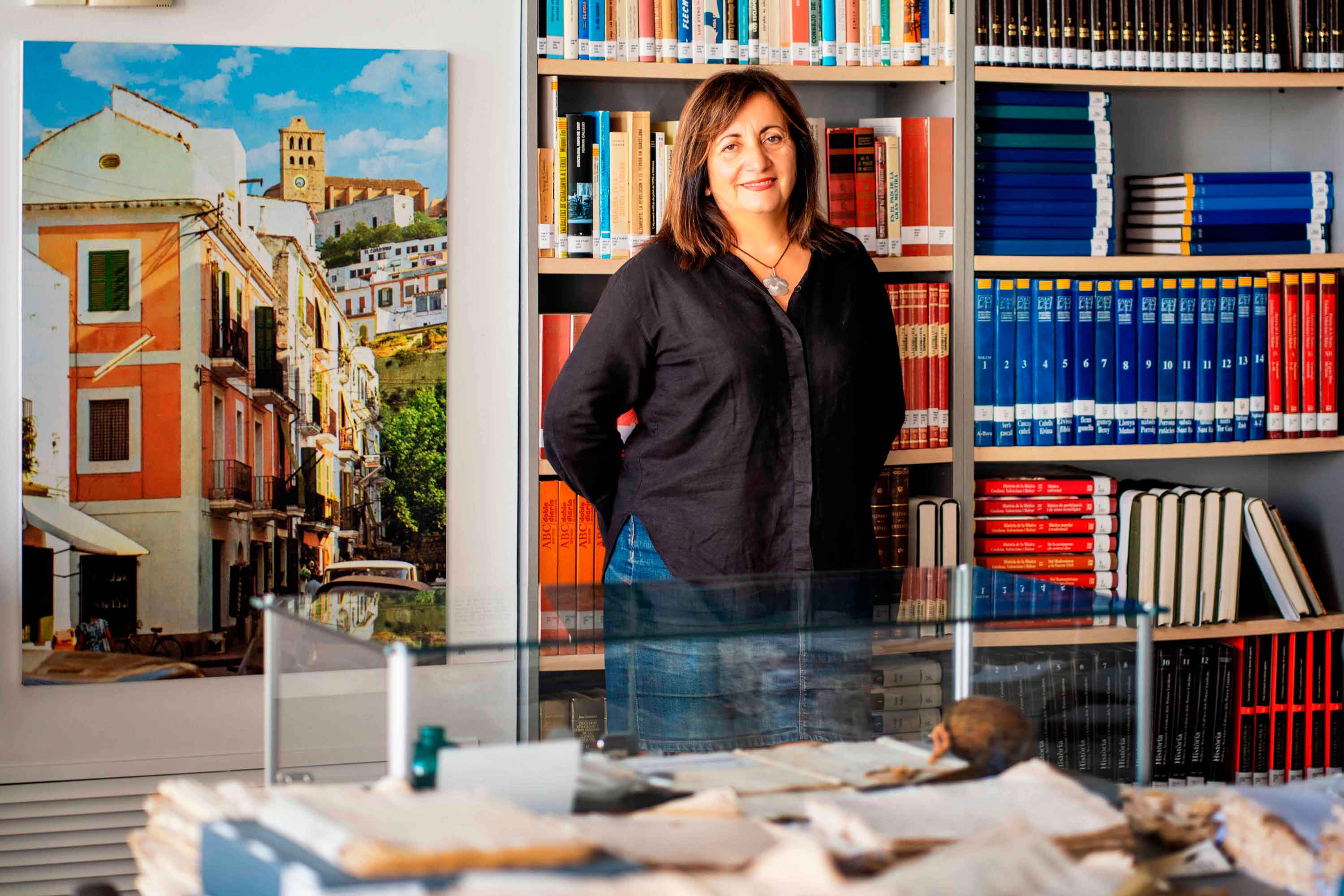
Historias del mar
Fanny Tur: «Baleària ya forma parte de la historia del transporte marítimo»
Ibicenca, activista medioambiental, historiadora, directora del archivo histórico de Eivissa… Fanny Tur Riera desempeñó, entre otros cargos públicos, el de consellera de Cultura del Govern Balear entre 2017 y 2019. Desde esta perspectiva, su análisis con visión histórica cobra valor: «Baleària ya forma parte de la historia del transporte marítimo de las Balears y del Mediterráneo», afirma antes de reflexionar sobre lo que supuso la irrupción de la naviera, ya que «los monopolios nunca son buenos y diversificar la oferta siempre tiene que beneficiar al usuario». En clave cultural y de género, esta historiadora destaca de la naviera Baleària cuestiones como «la atención en y al catalán, o poner nombres de mujer a algunos barcos, mostrando que la historia también la escribimos las mujeres». Desde la perspectiva ecologista, Tur Riera valora el compromiso de Baleària con la sostenibilidad partiendo de que «la actividad humana en general y el turismo y la gran movilidad en particular tienen unos efectos devastadores sobre el mar y el territorio». En este sentido, destaca, «todas las medidas que se pongan en práctica para minimizar los efectos de la masificación, como por ejemplo emplear energías renovables y colaborar con entidades ecologistas, ponen un grano de arena en una lucha que hace tiempo es imprescindible para la misma supervivencia». Pero si algo destaca de la aportación de Baleària esta exconsellera de Cultura del Govern Balear es el papel desempeñado por la Fundación Baleària, que ha hecho que «la creación pueda viajar a nuevos escenarios y no se quede en el lugar de origen. Para enriquecerse y crecer, el arte y la creación se tienen que mover mientras conservan sus raíces bien fuertes». Y ello, subraya, en combinación con la gestión de espacios culturales «en diferentes lugares —lo que desde la Fundación Baleària llaman las Llonges de la Cultura—, facilitando así que puedan acoger actividades, encuentros, investigación, muestras colectivas y creadores de todo el país para que se puedan encontrar y enriquecerse mutuamente» porque, reflexiona, «el arte y la investigación son trabajo propio, pero también son puesta en común y conocimiento mutuo». Creación cultural «En definitiva —asegura Fanny Tur— Baleària a través de su fundación ha hecho posible que la creación tenga movilidad, circule, se muestre en nuevos escenarios, porque así crece y encuentra nuevos paisajes… ha contribuido a la relación y el conocimiento mutuo entre creadores, facilitando que se encuentren, se conozcan y, en definitiva, que establezcanvínculos». En el caso de Balears, Fanny Tur considera que la de Baleària y de su fundación han sido una magnífica aportación favorecedora de la articulación social y cultural, además de subrayar la revitalización que ha supuesto la conexión, en todos los ámbitos, entre Dénia y Eivissa.
Read more

Historias del mar
De grumete a capitán. Vocabulario marítimo básico (I)
¿Dónde queda babor y estribor? ¿Cuál es la diferencia entre manga y eslora? Seguro que has oído una y mil veces términos como estos pero todavía te siguen generando dudas cuando subes a bordo de un ferri. No te preocupes, hemos preparado un glosario básico de léxico marítimo para que alimentes tu vocabulario y disfrutes todavía más de tu experiencia de viaje. Deja atrás tus titubeos de grumete y presume de hablar con la propiedad de un capitán. ¿Empezamos? PARTES DEL FERRI CASCO. El cuerpo del buque. La estructura ‘en neto’, sin máquinas, mástiles ni elementos accesorios para la navegación. CUBIERTA: Cada uno de los pisos de una embarcación. Forman la estructura que permiten un espacio habitable para la tripulación y el pasaje. Los barcos tienen varias cubiertas, tanto para la bodega -donde se ubica la carga y los vehículos- como para las zonas de pasajeros –con salones, áreas de butacas, restaurantes, etc.- siendo la principal la superior. QUILLA: Es la columna vertebral del barco. La pieza de hierro que va de popa a proa por la parte inferior del barco y en que se asienta toda su armazón.Constituye el principal refuerzo estructural de la embarcación, en el que se encastan los demás y sobre el que descargan su peso. [caption id="attachment_1776" align="aligncenter" width="800"] Corte transversal del ferri Martín i Soler de Baleària, donde se diferencia el casco, la quilla y las diferentes cubiertas.[/caption] VOLUMEN Y DIMENSIONES ESLORA: La longitud de la embarcación. O dicho de otra manera, la distancia de punta a punta de la estructura del buque. MANGA: La anchura (máxima) de un buque. PUNTAL. La altura de la bodega de la nave desde la quilla hasta el extremo de la cubierta superior. DESPLAZAMIENTO: El volumen de agua que desplaza la parte sumergida del barco. Es decir… el peso del barco. Ahora se entiende mejor ¿verdad?. POSICIÓN EN EL BARCO PROA y POPA. La proa es la parte delantera del barco. Tiene forma de cuña para que el buque pueda "cortar el agua”. Por el contrario, la popa es la parte posterior de la estructura del buque. BABOR y ESTRIBOR. Por babor se considera el lado izquierdo de un buque, mirando desde atrás hacia delante, esto es de popa a proa. Estribor es la banda o lado derecho de un buque, mirando desde atrás hacia delante, esto es de popa a proa. OBRA VIVA y MUERTA. La viva es la parte del casco bajo el agua. Es decir, desde la quilla a la línea de flotación a máxima carga. La muerta, la parte del casco que sobresale del mar MANIOBRAS ARRIAR. Aflojar o soltar un cabo (las cuerdas de a bordo). También se utilizan los términos LASCAR (aflojar) y LARGAR (soltar). Una advertencia: a bordo de los barcos sólo hay una cuerda, la del cronómetro. Las demás se llaman CABOS (y en los barcos grandes ESTACHAS). VIRAR. Lo contrario de arriar, es decir COBRAR o recuperar un cabo o el ancla, cuando el buque se encuentra fondeado. Por cierto, la maniobra de virar es propia de buques de vela y no tanto de ferris. ATRACAR. Operación para ubicar el buque en el lugar previsto del muelle. Concluye en el momento en que la embarcación AMARRA (o ata firmemente) el último cabo al NORAY o bolardo del muelle. Por cierto, la maniobra contraria a ATRACAR ser llama DESATRACAR. Lógico ¿no? BARLOVENTEAR. Maniobrar aprovechando la fuerza viento (a favor o en contra) para que el impulso sea lo más favorable a la embarcación. Por ejemplo, en el caso de una operación de atraque. CAPEAR. Se trata de una maniobra de navegación con mal tiempo. Consiste en tratar de mantener la proa al viento y con poca velocidad, para conseguir una trayectoria controlada y segura hasta que amaine el temporal. FONDEAR. Posicionar el buque en aguas establecidas para el anclaje. Y hasta aquí, por esta vez. Si quieres seguir aprendiendo sobre ferris y transporte marítimo, sigue navegando con el blog Entreolas y no te pierdas nuestra próxima entrega de vocabulario.
Read more