

Category Filter
Mallorca on foot and on two wheels
Blog entreolas

Mallorca on foot and on two wheels

Por Jesús Torné. Fotos: Tolo Balaguer


Sóller1baja


Mallorca's mild climate and good transport connections have led many walkers and, above all, cyclists to choose the island for their favourite sport. Here are ten routes to get your legs moving, either on foot or without leaving the saddle.


With 1,600 km of secondary roads and 468 km of signposted routes, Mallorca offers the perfect infrastructure for cycle tourism. Its diverse landscape —coastal, urban, rural and mountainous— also makes it ideal for exploring on foot. The experience is even better when the island is quieter, between October and May.


1: Contrasting landscapes along the old railway line
The Manacor–Artà greenway
This is not a circular route, so you will need to plan the return journey. At just under 30 kilometres, it is relatively easy and lets you enjoy a variety of landscapes without getting off the bike, following the old railway line. Starting east of Manacor, by the time you reach Artà you will have passed through tunnels and old stations and seen rural Mallorca, mountains, Mediterranean woodland and, in the distance, the coastline of s'Illot and Cala Millor. An easier alternative runs from Son Carrió to Son Servera.


2: Culture and the Serra de Tramuntana
Valldemossa, Deià and Sóller
The Valldemossa Charterhouse, where Chopin stayed, and Sóller's architectural heritage, particularly its Modernist buildings, make these two Serra villages well worth visiting. This road-bike route is for experienced cyclists. From Valldemossa, head to the Monastery of Miramar, founded by Ramon Llull, and Son Marroig, associated with Archduke Ludwig Salvator of Austria. Following the coast, you will reach Deià before descending to Sóller's Orange Valley. The route covers 36 km.


3: Mallorca's highest point, Lluc and the Cúber and Gorg Blau reservoirs
Puig Major from Sóller
Another demanding route for experienced cyclists, but one that belongs in this top ten because it climbs the island's highest peak. From Sóller, climb to the Monnàber tunnel, around 900 metres long. Roughly 2 km farther on is the military base, where permission must be requested to access Puig Major. From its 1,445-metre summit, you can enjoy some of the island's finest views. Afterwards, descend towards the Lluc Sanctuary, another essential stop, passing the Cúber and Gorg Blau reservoirs. From Coll de Sa Batalla, return to Sóller along the MA-10.
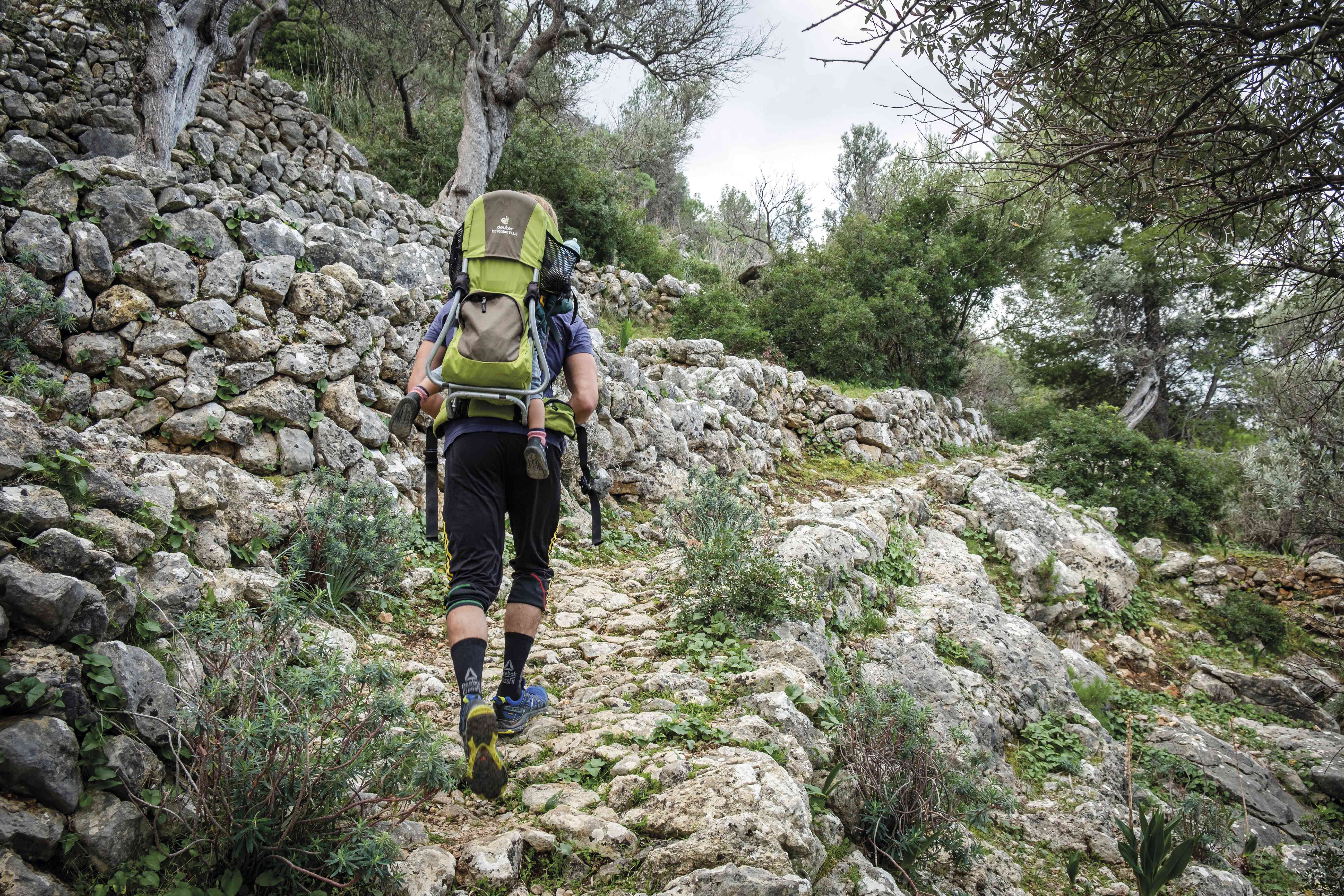
 

Walking among ancient stones


4: Beaches and natural parks by bike
From Cala Egos to Es Trenc
This non-circular road-bike route covers around 60 km. It takes in the coast of Santanyí and Campos and some of Mallorca's finest beaches. Starting in Cala Egos, head to Portopetro via Camí des Barranc, passing along the northern edge of Mondragó Natural Park. Continue alongside the torrent d'en Reieta to Santanyí, then cross this attractive town and ride on to Es Llombards, Ses Salines and Colònia de Sant Jordi. There you can leave the bike and, if the weather allows, walk for a while and take a dip in Es Trenc-Salobrar Natural Park or, at the other end, Es Carbó. All are spectacular beaches.


5: Great views of the Serra and the coast
Planícia from Esporles
This 30 km mountain-bike route is of moderate difficulty. Starting in Esporles, one of the Serra's prettiest villages, head towards Mirador de Mar along the old path that once linked the village with Port de Calonge. The views are spectacular. Return towards the MA-10 to descend towards Banyalbufar, but turn off first towards Planícia. Depending on your energy and available time, you can explore one of the three routes within this public estate. On the return journey, stop at the Es Verger viewpoint before continuing to another beautiful village, Banyalbufar, and from there back to Esporles.


6: Phoenician necropolis beside the beach
Son Real
The walk through the public estate of Son Real, in the municipality of Santa Margalida, is especially suitable for families. It is only around 2 km long, with no significant climbs or descents, and includes plenty to interest children. There are four possible routes, but the essential one leads to the impressive Punta des Fenicis necropolis, with burials dating from the
Iron Age through to Roman times. And while you are there, you can enjoy a swim at the beach next to it.
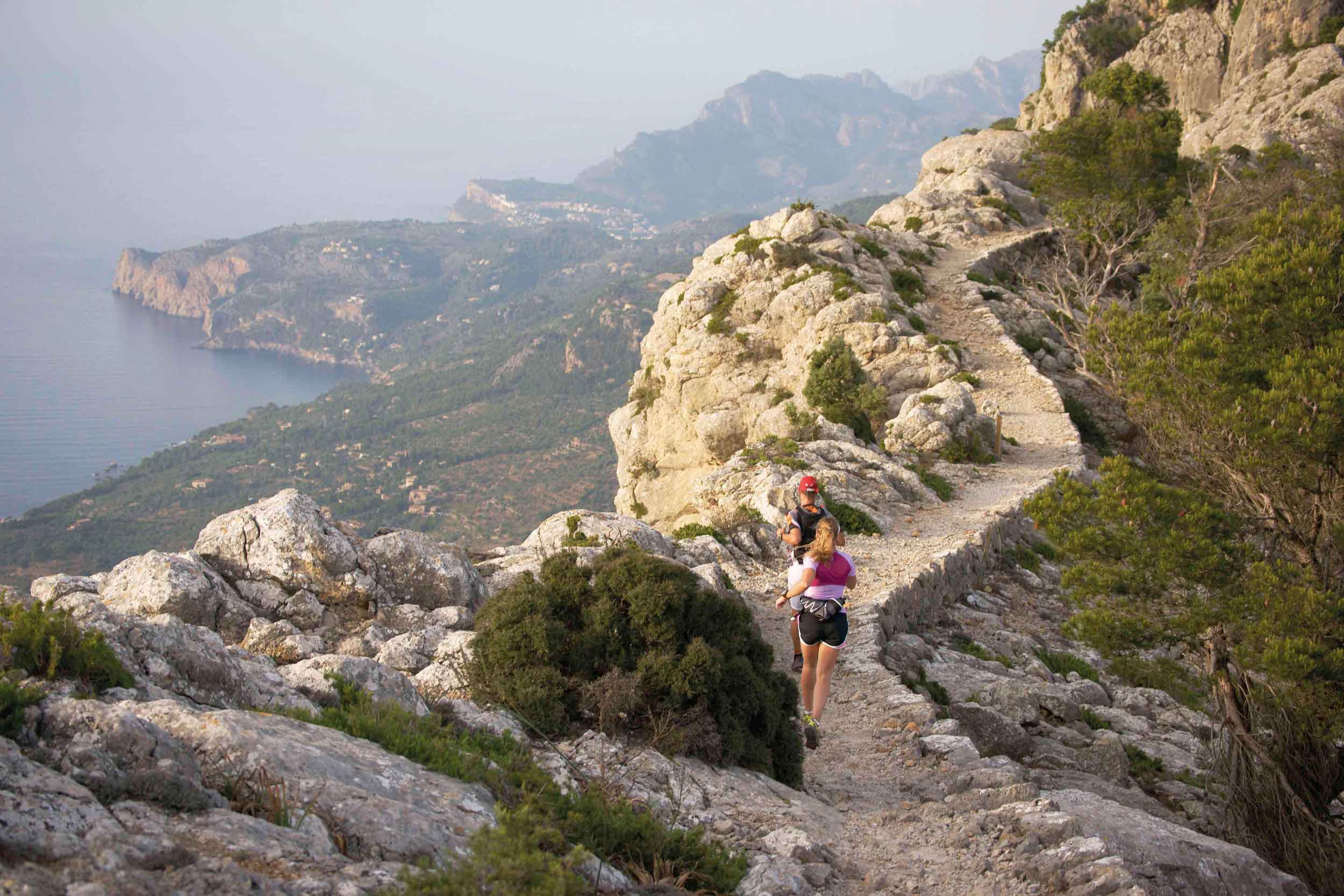
 

Sea and mountains in Sóller
 

7: Family walking and cycling
S'Albufera
S'Albufera de Mallorca Natural Park, in the north of the island, is ideal for families. There are four routes that can be completed on foot or by bike: Sa Roca, Es Colombars, Es Cibollars and Es Camí d'Enmig-Ses Puntes. The longest, around three hours, is the last of these, but all of them offer the chance to enjoy the park's rich wildlife, particularly its birdlife.


8: One of Mallorca's most photographed horizons
Torrent de Pareis
There are several routes, some even suitable only for mountaineers, leading to the spectacular mouth of this torrent, one of Mallorca's most photogenic beaches. The classic route is the descent through the gorge from s'Entreforc, where the Gorg Blau reservoir flows out: it takes around 6 hours, covers 5 km and requires experience or a good guide. The easiest family-friendly option is the path beginning at Sa Calobra beach.


9: Ramon Llull's place of contemplation
Cura Sanctuary
If Ramon Llull chose this as a place for spiritual retreat, there must have been a reason. Our suggested route starts in the village of Randa before climbing to Cura Sanctuary, where the Mallorcan philosopher withdrew in the 13th century and founded his school. Along the way, as well as enjoying impressive views, you will visit the Sant Honorat hermitage and Nostra Senyora de Gràcia Sanctuary. On the final section, along Camí de Bon Pastor, you can see some galleries that were used as ammunition stores during the Spanish Civil War. The only real difficulty is the access to Puig de Son Reus.


10: Refuge for Trappist monks during the French Revolution
La Trapa
Several paths lead to La Trapa, a monastery founded in 1810 by French Trappist monks who, twenty years after the storming of the Bastille, decided to flee the country. Abandoned only a few years later, the estate was acquired in 1980 by the environmental group GOB to prevent development. The most popular route to La Trapa begins at s'Arracó cemetery. Another route from Sant Elm follows the coastline. A third goes via Coll de Sa Gramola and is a good choice when the rocks are wet. All of them provide exceptional views of the Sa Dragonera islet.
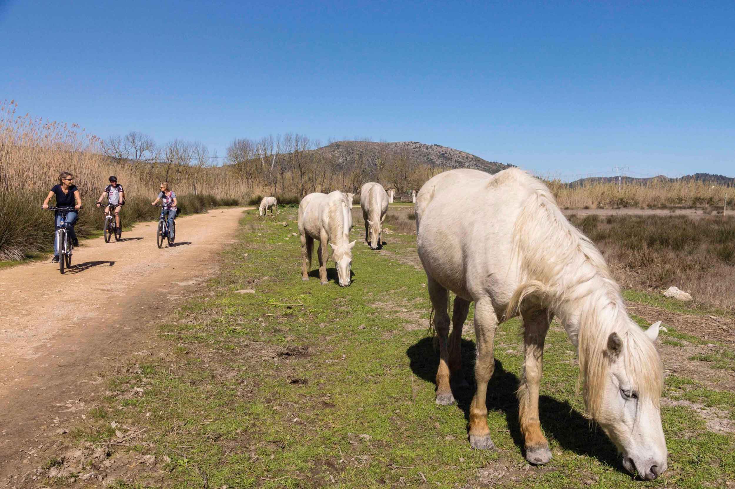
 

Horses accompany cycle tourists

Asset Publisher
Fanny Tur: «Baleària ya forma parte de la historia del transporte marítimo»
Historias del mar

Fanny Tur: «Baleària ya forma parte de la historia del transporte marítimo»

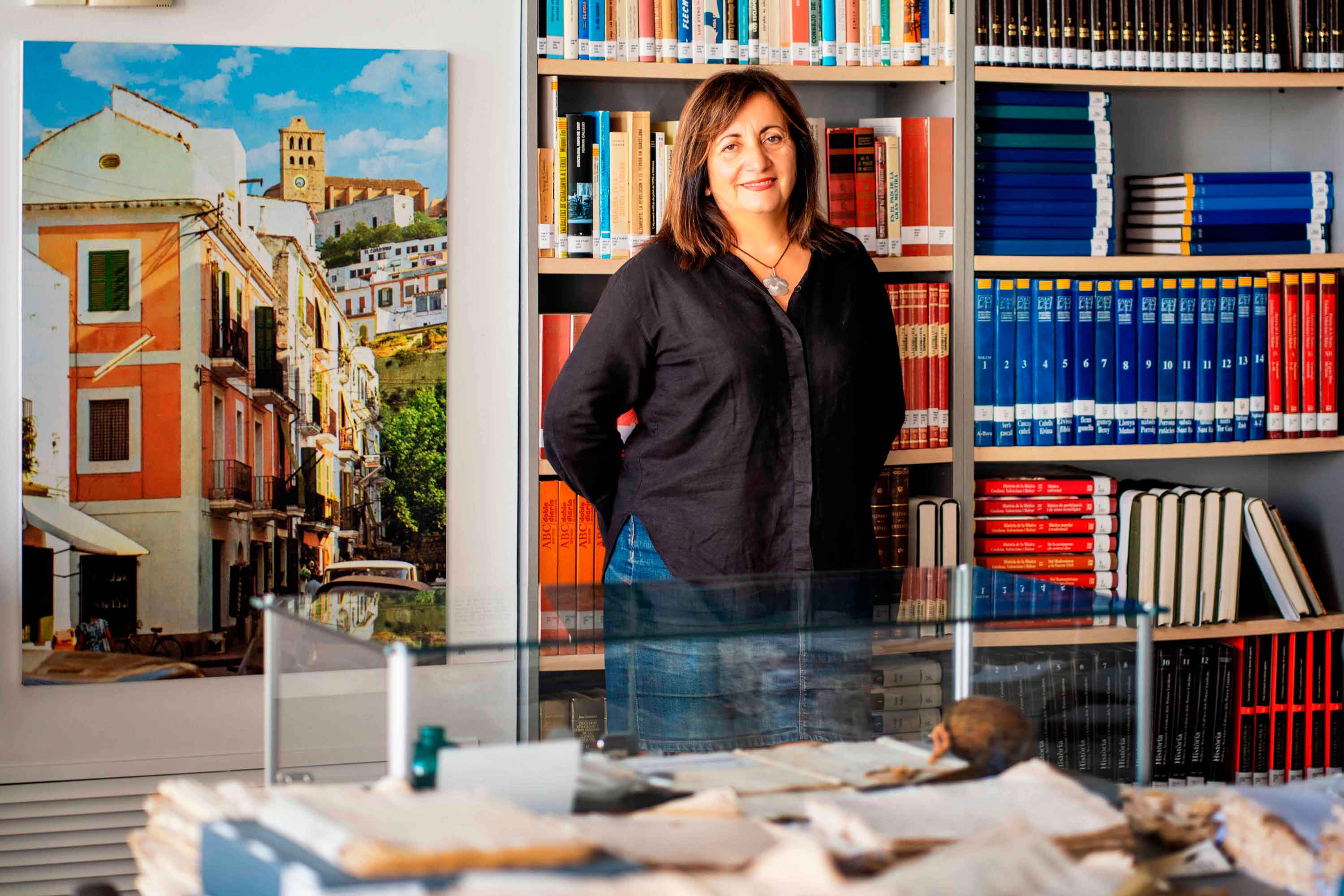
  Ibicenca, activista medioambiental, historiadora, directora del archivo histórico de Eivissa… Fanny Tur Riera desempeñó, entre otros cargos públicos, el de consellera de Cultura del Govern Balear entre 2017 y 2019. Desde esta perspectiva, su análisis con visión histórica cobra valor: «Baleària ya forma parte de la historia del transporte marítimo de las Balears y del Mediterráneo», afirma antes de reflexionar sobre lo que supuso la irrupción de la naviera, ya que «los monopolios nunca son buenos y diversificar la oferta siempre tiene que beneficiar al usuario». En clave cultural y de género, esta historiadora destaca de la naviera Baleària cuestiones como «la atención en y al catalán, o poner nombres de mujer a algunos barcos, mostrando que la historia también la escribimos las mujeres».   Desde la perspectiva ecologista, Tur Riera valora el compromiso de Baleària con la sostenibilidad partiendo de que «la actividad humana en general y el turismo y la gran movilidad en particular tienen unos efectos devastadores sobre el mar y el territorio». En este sentido, destaca, «todas las medidas que se pongan en práctica para minimizar los efectos de la masificación, como por ejemplo emplear energías renovables y colaborar con entidades ecologistas, ponen un grano  de arena en una lucha que hace tiempo es imprescindible para la misma supervivencia». Pero si algo destaca de la aportación de Baleària esta exconsellera de Cultura del Govern Balear es el papel desempeñado por la Fundación Baleària, que ha hecho que «la creación pueda viajar a nuevos escenarios y no se quede en el lugar de origen. Para enriquecerse y crecer, el arte y la creación se tienen que mover mientras conservan sus raíces bien fuertes». Y ello, subraya, en combinación con la gestión de espacios culturales «en diferentes lugares —lo que desde la Fundación Baleària llaman las Llonges de la Cultura—, facilitando así que puedan acoger actividades, encuentros, investigación, muestras colectivas y creadores de todo el país para que se puedan encontrar y enriquecerse mutuamente» porque, reflexiona, «el arte y la investigación son trabajo propio, pero también son puesta en común y conocimiento mutuo».   Creación cultural «En definitiva —asegura Fanny Tur— Baleària a través de su fundación ha hecho posible que la creación tenga movilidad, circule, se muestre en nuevos escenarios, porque así crece y encuentra nuevos paisajes… ha contribuido a la relación y el conocimiento mutuo entre creadores, facilitando que se encuentren, se conozcan y, en definitiva, que establezcanvínculos». En el caso de Balears, Fanny Tur considera que la de Baleària y de su fundación han sido una magnífica aportación favorecedora de la articulación social y cultural, además de subrayar la revitalización que ha supuesto la conexión, en todos los ámbitos, entre Dénia y Eivissa.


Read more
De grumete a capitán. Vocabulario marítimo básico (I)
Historias del mar

De grumete a capitán. Vocabulario marítimo básico (I)

¿Dónde queda babor y estribor? ¿Cuál es la diferencia entre manga y eslora? Seguro que has oído una y mil veces términos como estos pero todavía te siguen generando dudas cuando subes a bordo de un ferri. No te preocupes, hemos preparado un glosario básico de léxico marítimo para que alimentes tu vocabulario y disfrutes todavía más de tu experiencia de viaje. Deja atrás tus titubeos de grumete y presume de hablar con la propiedad de un capitán. ¿Empezamos?   PARTES DEL FERRI CASCO. El cuerpo del buque. La estructura ‘en neto’, sin máquinas, mástiles ni elementos accesorios para la navegación. CUBIERTA: Cada uno de los pisos de una embarcación. Forman la estructura que permiten un espacio habitable para la tripulación y el pasaje. Los barcos tienen varias cubiertas, tanto para la bodega -donde se ubica la carga y los vehículos- como para las zonas de pasajeros –con salones, áreas de butacas, restaurantes, etc.- siendo la principal la superior. QUILLA: Es la columna vertebral del barco. La pieza de hierro que va de popa a proa por la parte inferior del barco y en que se asienta toda su armazón.Constituye el principal refuerzo estructural de la embarcación, en el que se encastan los demás y sobre el que descargan su peso.   [caption id="attachment_1776" align="aligncenter" width="800"] Corte transversal del ferri Martín i Soler de Baleària, donde se diferencia el casco, la quilla y las diferentes cubiertas.[/caption]   VOLUMEN Y DIMENSIONES ESLORA: La longitud de la embarcación. O dicho de otra manera, la distancia de punta a punta de la estructura del buque. MANGA: La anchura (máxima) de un buque. PUNTAL. La altura de la bodega de la nave desde la quilla hasta el extremo de la cubierta superior. DESPLAZAMIENTO: El volumen de agua que desplaza la parte sumergida del barco. Es decir… el peso del barco. Ahora se entiende mejor ¿verdad?.     POSICIÓN EN EL BARCO PROA y POPA. La proa es la parte delantera del barco. Tiene forma de cuña para que el buque pueda "cortar el agua”. Por el contrario, la popa es la parte posterior de la estructura del buque. BABOR y ESTRIBOR. Por babor se considera el lado izquierdo de un buque, mirando desde atrás hacia delante, esto es de popa a proa. Estribor es la banda o lado derecho de un buque, mirando desde atrás hacia delante, esto es de popa a proa. OBRA VIVA y MUERTA. La viva es la parte del casco bajo el agua. Es decir, desde la quilla a la línea de flotación a máxima carga. La muerta, la parte del casco que sobresale del mar   MANIOBRAS ARRIAR. Aflojar o soltar un cabo (las cuerdas de a bordo). También se utilizan los términos LASCAR (aflojar) y LARGAR (soltar). Una advertencia: a bordo de los barcos sólo hay una cuerda, la del cronómetro. Las demás se llaman CABOS (y en los barcos grandes ESTACHAS). VIRAR. Lo contrario de arriar, es decir COBRAR o recuperar un cabo o el ancla, cuando el buque se encuentra fondeado. Por cierto, la maniobra de virar es propia de buques de vela y no tanto de ferris. ATRACAR. Operación para ubicar el buque en el lugar previsto del muelle. Concluye en el momento en que la embarcación AMARRA (o ata firmemente) el último cabo al NORAY o bolardo del muelle. Por cierto, la maniobra contraria a ATRACAR ser llama DESATRACAR. Lógico ¿no? BARLOVENTEAR. Maniobrar aprovechando la fuerza viento (a favor o en contra) para que el impulso sea lo más favorable a la embarcación. Por ejemplo, en el caso de una operación de atraque. CAPEAR. Se trata de una maniobra de navegación con mal tiempo. Consiste en  tratar de mantener la proa al viento y con poca velocidad, para conseguir una trayectoria controlada y segura hasta que amaine el temporal. FONDEAR. Posicionar el buque en aguas establecidas para el anclaje.     Y hasta aquí, por esta vez. Si quieres seguir aprendiendo sobre ferris y transporte marítimo, sigue navegando con el blog Entreolas y no te pierdas nuestra próxima entrega de vocabulario. 


Read more