

 English
 Spanish
 Catalan
 French
 Italian
 Rodeada de parques naturales, Algeciras tiene una ubicación afortunada. Mientras se baña en aguas del Atlántico y del Mediterráneo, a apenas unos kilómetros cuenta con una serie de pequeñas poblaciones costeras que se parecen mucho al paraíso. También pueblos montañosos que invitan a descubrir paisajes de otra época. Bonitas carreteras llevan hasta cada destino, que en conjunto componen la perfecta tentación para organizar un road trip gaditano que puede durar un día, una semana o toda una vida. El primer destino se ubica a 27 kilómetros hacia el norte. En pleno Parque Natural de Los Alcornocales se levanta el castillo de Castellar de la Frontera. Una vieja fortaleza que fue rehabilitada en los años 60 hoy convertida en hotel y cuya medina interior está habitada por un puñado de vecinos y multitud de coloridas macetas que iluminan los blancos callejones. Con miradores al Estrecho de Gibraltar y al embalse del Guadarranque, la aldea es perfecta para la desconexión y para conocer una naturaleza donde el alcornoque y la encina son los principales protagonistas. Una sinuosa carretera lleva hasta la costa para continuar junto al Parque Natural del Estrecho hasta a Tarifa, apenas a una veintena de kilómetros de Algeciras. El centro histórico, rodeado por murallas, es uno de sus mayores atractivos. Pequeñas calles salpicadas de plazas conforman un urbanismo típicamente árabe, repletas ahora de numerosas tiendas de moda y pequeños cafés de estilo informal. La gastronomía ofrece aquí algunas paradas obligatorias para tapear y disfrutar del pescado más característico de la zona, el atún. El Francés es uno de los restaurantes más interesantes, como también lo es El otro Melli, con una estupenda terraza en la que saborear el sol gaditano y los productos del mar. Junto al puerto, Las Campanas es uno de esos establecimientos frecuentados por lugareños para disfrutar de un buen menú, que puede estar compuesto por unas sabrosas ortiguillas fritas o unas cañaíllas recién recogidas. No hay que perderse el recinto del Castillo de Guzmán el Bueno ni, tampoco, los originales dulces de la pastelería La Tarifeña, siempre a rebosar. [caption id="attachment_2080" align="aligncenter" width="1000"] 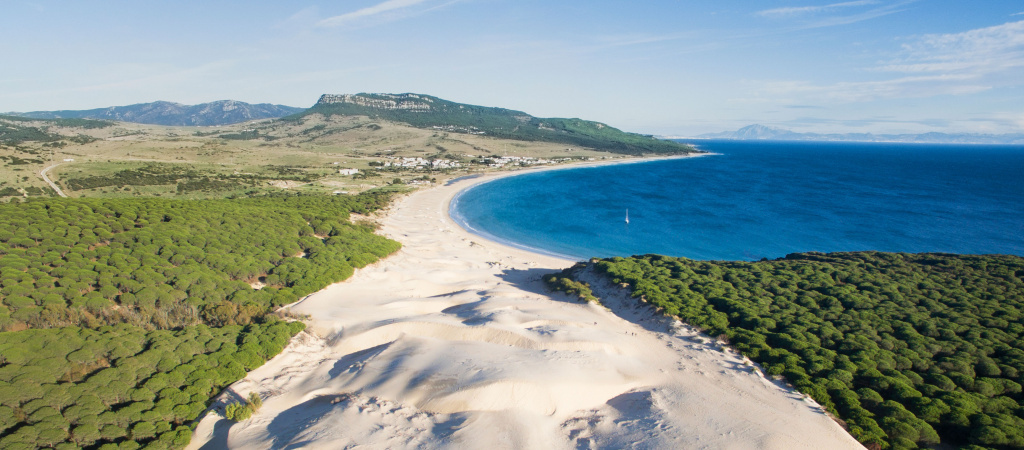 Playa de la Bolonia (foto: Turismo de Cádiz).[/caption] La Nacional IV continúa junto a la playa de los Lances hasta la de Valdevaqueros, donde las cometas surcan el vuelo para placer de los amantes del kite surf. Bonitos chiringuitos como Tumbao se reparten los alrededores junto a hoteles de aires surferos y diversas áreas de camping. Merece entonces la pena desviarse hacia Punta Paloma por un estrecho camino que a veces desaparece bajo la duna de Valdevaqueros. Un exquisito lugar para disfrutar de la arena, el viento salvaje y preciosas vistas de la costa. [caption id="attachment_2078" align="aligncenter" width="1000"]
 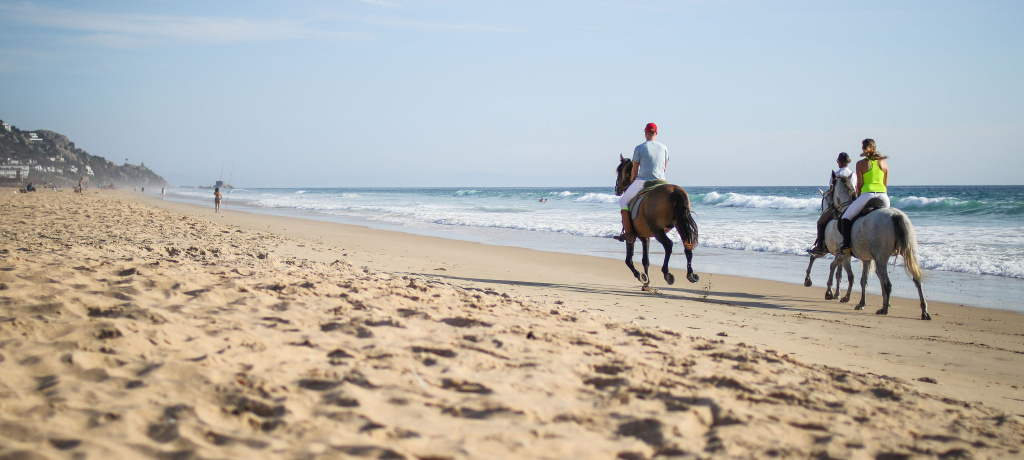 Paseo a caballo por la playa de Zahara (foto: Nacho Sánchez).[/caption] La carretera se aleja entonces del Atlántico en dirección a Conil de la Frontera. Antes, no hay que perder de vista el desvío hacia la preciosa playa de Bolonia, donde además de la altísima duna del mismo nombre (declarada monumento natural) y la vieja ciudad romana de Baelo Claudia, se esconde uno de los mejores restaurantes de Andalucía. Es familiar, se llama Las Rejas y sirve un atún en manteca inigualable, además de pescados del día y sabrosos arroces. De vuelta a la ruta principal, un poco más adelante un nuevo desvío se acerca esta vez hacia la pequeña población de Zahara de los Atunes. Pueblo blanco y marinero con playas kilométricas, dispone de un sinfín de restaurantes. El atún de Casa Juanito, el bao de cangrejo en Ramón Pipi o los satays de atún de la Taberna Trasteo merecen por sí mismos un viaje. Como también una excursión a la playa de El Cañuelo, junto al faro de Camarinal y los sorprendentes búnquers de la Guerra Civil. [caption id="attachment_2081" align="aligncenter" width="1000"]
 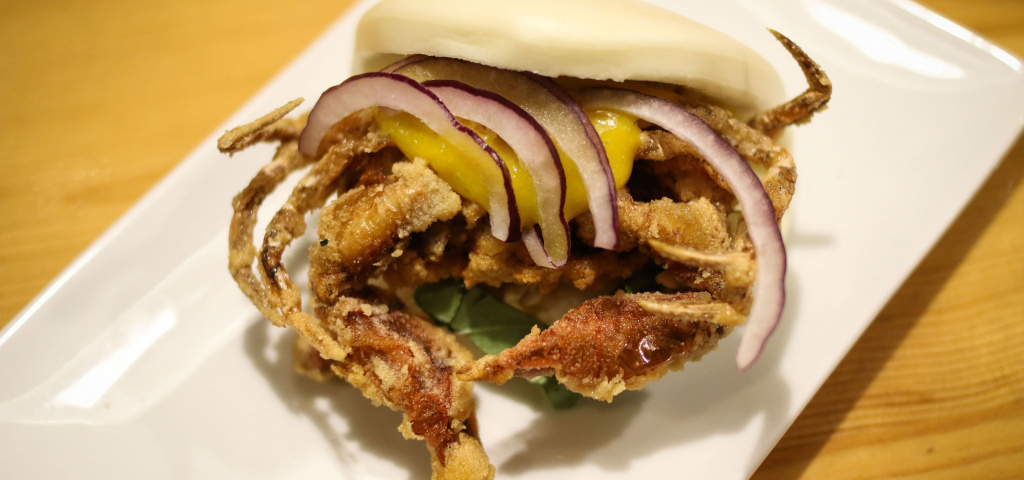 Bao de cangrejo en Ramón Pipi.[/caption] El road trip puede seguir entonces por la A-2231 en dirección a Barbate, donde se ubica el exquisito restaurante El Campero y, atravesando el Parque Natural de La Breña, llegar hasta las playas de Caños de Meca para pasear junto al faro de Trafalgar y ver atardecer en la infinita costa de El Palmar. Una penúltima escapada lleva hasta Vejer de la Frontera, pueblo típicamente árabe con un urbanismo laberíntico cuyos secretos se pueden desgranar gracias a las rutas guiadas y cantadas del equipo de Marimantas Vejer. Finalmente, el viaje culmina en Conil de la Frontera (a 80 kilómetros de Algeciras). Es el momento de olvidarse del coche y acercarse a la plaza Puerta de la Villa y pedir un montadito de marrajo en el bar Los Hermanos o unas sardinas ahumadas en Feduchy Tapas. A partir de ahí, lo mejor es adentrarse en el casco histórico de Conil, seguir tapeando en la taberna El Capricho o el verdiblanco Bar Andaluz para seguir luego dejándose llevar por unas calles peatonales llenas de vida, alegría y sentido del humor. Nacho Sánchez | Periodista

 X
X 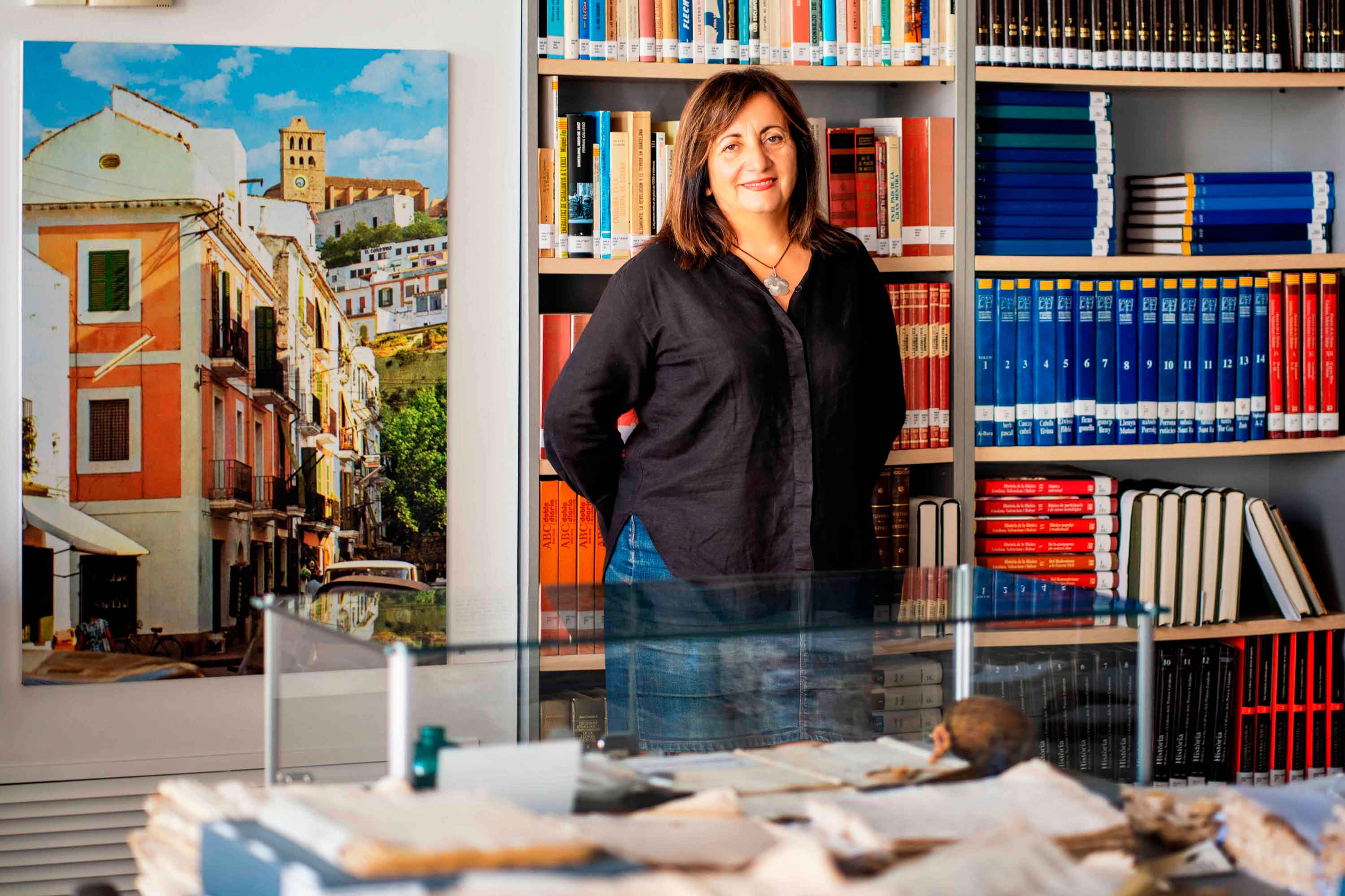
Historias del mar
Fanny Tur: «Baleària ya forma parte de la historia del transporte marítimo»
Ibicenca, activista medioambiental, historiadora, directora del archivo histórico de Eivissa… Fanny Tur Riera desempeñó, entre otros cargos públicos, el de consellera de Cultura del Govern Balear entre 2017 y 2019. Desde esta perspectiva, su análisis con visión histórica cobra valor: «Baleària ya forma parte de la historia del transporte marítimo de las Balears y del Mediterráneo», afirma antes de reflexionar sobre lo que supuso la irrupción de la naviera, ya que «los monopolios nunca son buenos y diversificar la oferta siempre tiene que beneficiar al usuario». En clave cultural y de género, esta historiadora destaca de la naviera Baleària cuestiones como «la atención en y al catalán, o poner nombres de mujer a algunos barcos, mostrando que la historia también la escribimos las mujeres». Desde la perspectiva ecologista, Tur Riera valora el compromiso de Baleària con la sostenibilidad partiendo de que «la actividad humana en general y el turismo y la gran movilidad en particular tienen unos efectos devastadores sobre el mar y el territorio». En este sentido, destaca, «todas las medidas que se pongan en práctica para minimizar los efectos de la masificación, como por ejemplo emplear energías renovables y colaborar con entidades ecologistas, ponen un grano de arena en una lucha que hace tiempo es imprescindible para la misma supervivencia». Pero si algo destaca de la aportación de Baleària esta exconsellera de Cultura del Govern Balear es el papel desempeñado por la Fundación Baleària, que ha hecho que «la creación pueda viajar a nuevos escenarios y no se quede en el lugar de origen. Para enriquecerse y crecer, el arte y la creación se tienen que mover mientras conservan sus raíces bien fuertes». Y ello, subraya, en combinación con la gestión de espacios culturales «en diferentes lugares —lo que desde la Fundación Baleària llaman las Llonges de la Cultura—, facilitando así que puedan acoger actividades, encuentros, investigación, muestras colectivas y creadores de todo el país para que se puedan encontrar y enriquecerse mutuamente» porque, reflexiona, «el arte y la investigación son trabajo propio, pero también son puesta en común y conocimiento mutuo». Creación cultural «En definitiva —asegura Fanny Tur— Baleària a través de su fundación ha hecho posible que la creación tenga movilidad, circule, se muestre en nuevos escenarios, porque así crece y encuentra nuevos paisajes… ha contribuido a la relación y el conocimiento mutuo entre creadores, facilitando que se encuentren, se conozcan y, en definitiva, que establezcanvínculos». En el caso de Balears, Fanny Tur considera que la de Baleària y de su fundación han sido una magnífica aportación favorecedora de la articulación social y cultural, además de subrayar la revitalización que ha supuesto la conexión, en todos los ámbitos, entre Dénia y Eivissa.
Read more

Historias del mar
De grumete a capitán. Vocabulario marítimo básico (I)
¿Dónde queda babor y estribor? ¿Cuál es la diferencia entre manga y eslora? Seguro que has oído una y mil veces términos como estos pero todavía te siguen generando dudas cuando subes a bordo de un ferri. No te preocupes, hemos preparado un glosario básico de léxico marítimo para que alimentes tu vocabulario y disfrutes todavía más de tu experiencia de viaje. Deja atrás tus titubeos de grumete y presume de hablar con la propiedad de un capitán. ¿Empezamos? PARTES DEL FERRI CASCO. El cuerpo del buque. La estructura ‘en neto’, sin máquinas, mástiles ni elementos accesorios para la navegación. CUBIERTA: Cada uno de los pisos de una embarcación. Forman la estructura que permiten un espacio habitable para la tripulación y el pasaje. Los barcos tienen varias cubiertas, tanto para la bodega -donde se ubica la carga y los vehículos- como para las zonas de pasajeros –con salones, áreas de butacas, restaurantes, etc.- siendo la principal la superior. QUILLA: Es la columna vertebral del barco. La pieza de hierro que va de popa a proa por la parte inferior del barco y en que se asienta toda su armazón.Constituye el principal refuerzo estructural de la embarcación, en el que se encastan los demás y sobre el que descargan su peso. [caption id="attachment_1776" align="aligncenter" width="800"] Corte transversal del ferri Martín i Soler de Baleària, donde se diferencia el casco, la quilla y las diferentes cubiertas.[/caption] VOLUMEN Y DIMENSIONES ESLORA: La longitud de la embarcación. O dicho de otra manera, la distancia de punta a punta de la estructura del buque. MANGA: La anchura (máxima) de un buque. PUNTAL. La altura de la bodega de la nave desde la quilla hasta el extremo de la cubierta superior. DESPLAZAMIENTO: El volumen de agua que desplaza la parte sumergida del barco. Es decir… el peso del barco. Ahora se entiende mejor ¿verdad?. POSICIÓN EN EL BARCO PROA y POPA. La proa es la parte delantera del barco. Tiene forma de cuña para que el buque pueda "cortar el agua”. Por el contrario, la popa es la parte posterior de la estructura del buque. BABOR y ESTRIBOR. Por babor se considera el lado izquierdo de un buque, mirando desde atrás hacia delante, esto es de popa a proa. Estribor es la banda o lado derecho de un buque, mirando desde atrás hacia delante, esto es de popa a proa. OBRA VIVA y MUERTA. La viva es la parte del casco bajo el agua. Es decir, desde la quilla a la línea de flotación a máxima carga. La muerta, la parte del casco que sobresale del mar MANIOBRAS ARRIAR. Aflojar o soltar un cabo (las cuerdas de a bordo). También se utilizan los términos LASCAR (aflojar) y LARGAR (soltar). Una advertencia: a bordo de los barcos sólo hay una cuerda, la del cronómetro. Las demás se llaman CABOS (y en los barcos grandes ESTACHAS). VIRAR. Lo contrario de arriar, es decir COBRAR o recuperar un cabo o el ancla, cuando el buque se encuentra fondeado. Por cierto, la maniobra de virar es propia de buques de vela y no tanto de ferris. ATRACAR. Operación para ubicar el buque en el lugar previsto del muelle. Concluye en el momento en que la embarcación AMARRA (o ata firmemente) el último cabo al NORAY o bolardo del muelle. Por cierto, la maniobra contraria a ATRACAR ser llama DESATRACAR. Lógico ¿no? BARLOVENTEAR. Maniobrar aprovechando la fuerza viento (a favor o en contra) para que el impulso sea lo más favorable a la embarcación. Por ejemplo, en el caso de una operación de atraque. CAPEAR. Se trata de una maniobra de navegación con mal tiempo. Consiste en tratar de mantener la proa al viento y con poca velocidad, para conseguir una trayectoria controlada y segura hasta que amaine el temporal. FONDEAR. Posicionar el buque en aguas establecidas para el anclaje. Y hasta aquí, por esta vez. Si quieres seguir aprendiendo sobre ferris y transporte marítimo, sigue navegando con el blog Entreolas y no te pierdas nuestra próxima entrega de vocabulario.
Read more