

 English
 Spanish
 Catalan
 French
 Italian
 Cada pasajero viaja en barco por algún motivo concreto, unos lo hacen por placer, otros por visitar a su familia, por trabajo, y también hay quién lo hace para aprender. Como los 54 alumnos de primero de la E.S.O. del Instituto de Enseñanza Secundaria “Gabriel Císcar” de Oliva (València), que hace unos días se embarcaron en el fast ferry Ramon Llull para participar en el programa educativo que ofrece la Fundació Baleària, “Xpedicionària: un dia a Formentera”. Esta propuesta didáctica, que tiene como objetivo la sensibilización y educación ambiental, permite que cada año más de 500 alumnos de centros educativos de Catalunya y Comunitat Valenciana se embarquen en los ferries de la naviera para realizar actividades de concienciación y preservación del mar. Este año, el proyecto ha presentado una nueva propuesta para descubrir la pitiusa menor a través de los servicios de conexión directa entre Dénia con la isla balear. Un programa intenso, que se concentra en un día, pero que pretende, a través de una metodología totalmente práctica, motivar a los estudiantes a implicarse de una forma más activa en la conservación del medio ambiente. “Se trata de una propuesta de excursión intensa que permite conocer un territorio único por sus características medioambientales y que gracias al viaje en barco, desde Dénia lo tenemos a tiro de piedra”, declara Víctor, uno de los responsables del programa. RUMBO A LA PITIUSA MENOR A las ocho de la mañana se citaban, alumnos y profesores, en las instalaciones de Baleària Port de Dénia. En el muelle, el Ramon Llull ya lucía amarrado, listo para ser embarcado por los pasajeros de su primer trayecto del día, el de las 9.30 horas. Justo a tiempo, el jefe de cabina del Llull, Alfonso Monfort, ordenaba el embarque de pasajeros y el grupo de estudiantes se distribuía en la primera cubierta del fast ferry, con el murmullo de chavalería que todos hemos vivido y que provoca un día de excursión. Estaban contentos, nerviosos y un poco impacientes. Es normal, para ellos era su viaje de fin de curso, y poder estar un día por Formentera para descubrir su flora y fauna y tomar el primer baño del año, era motivo suficiente de celebración. [caption id="attachment_2352" align="aligncenter" width="1000"] 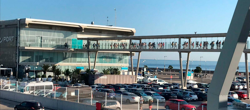 Los estudiantes, camino de embarcar en el 'Ramon Llull'.[/caption] ¡BIENVENIDOS A FORMENTERA! Entre idas y venidas de la terraza cubierta, pasaban los alumnos olivenses una travesía que finalizaba a las 11.30 horas de la mañana, cuando el capitán Pepe Borruel atracaba el buque en el puerto de Formentera. Juntos, como un banco de peces en el Mediterráneo, los estudiantes desembarcaban y ponían pies en tierra firme. Allí les esperaba Marga Serra, guía del programa educativo y la encargada de llevarles durante toda la jornada expedicionaria por la pitiusa menor. Tras una breve bienvenida, se montaban en un autobús rumbo a Can Marroig, el centro de interpretación del Parque Natural de Ses Salines de Ibiza y Formentera. Una vez allí, “a través de actividades interactivas, se mostró a los niños participantes cómo funcionaba la Salinera y las especies protegidas que habitan en la isla. El principal objetivo es que conozcan las especies endémicas, únicas de este ecosistema, ya que no existen en otras partes del mundo”, afirma Serra, que además es bióloga marina y lleva 12 años como educadora ambiental. Tras descubrir las curiosidades de las distintas especies, como la posidonia oceánica, visitaban la playa de Ses Illetes, para conocer la importancia ecológica de su sistema dunar y aprovechar el paisaje para comer y darse un chapuzón entre sus aguas cristalinas, cita obligada cuando se visita la isla. [caption id="attachment_2349" align="aligncenter" width="1000"]
 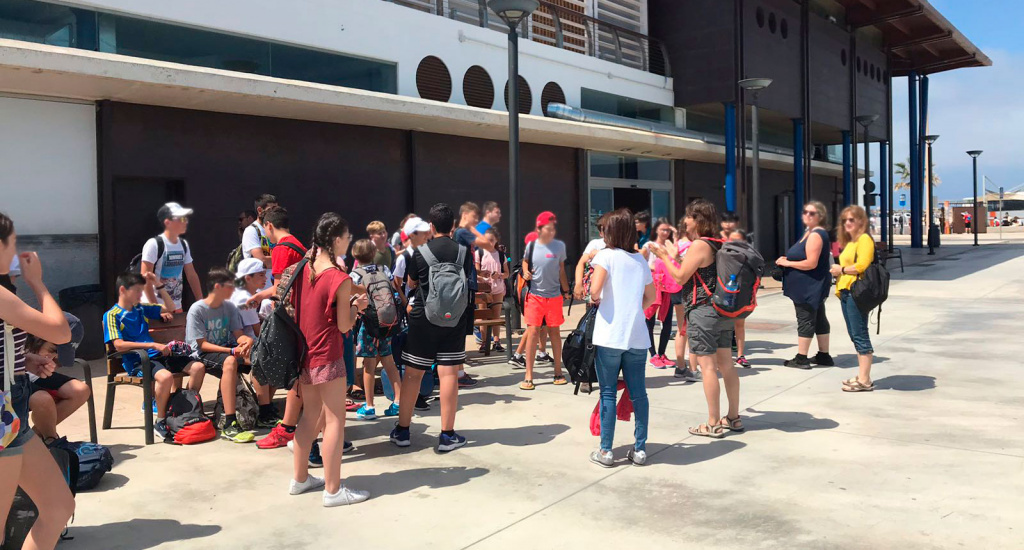 Marga Serra da la bienvenida a los alumnos en el Puerto de la Sabina de Formentera.[/caption] LA MOLA Y SANT FRANCESC Por la tarde vendrían las visitas a las otras postales paisajísticas características de Formentera, el Far de la Mola y su mirador, para contemplar una de las mejores panorámicas del Mediterráneo. Después, visitaban el pueblo de Sant Francesc para dar un paseo por sus casas blancas estilo mediterráneo. Con el atardecer, concluía la jornada, y los jóvenes exploradores se embarcaban de nuevo en el ‘Llull’ de regreso a casa. “Ha sido una experiencia muy enriquecedora, pues los niños, con su vivencia personal, han reconocido especies del ecosistema que habíamos estudiado en clase, como la ‘sargantana’, típica de las Baleares”, comentaba Amparo Gadea, profesora de Biología. Pese a haber estado todo el día, y desde primera hora en ruta, todavía les quedaban fuerzas para comentar durante el trayecto todo lo vivido durante el día. “Lo que más me ha gustado ha sido poder nadar en la playa de Ses Salines, ha sido muy divertido”, afirma una alumna de primero B. Ya se sabe que los niños tienen una energía inagotable. [caption id="attachment_2351" align="aligncenter" width="1000"]
 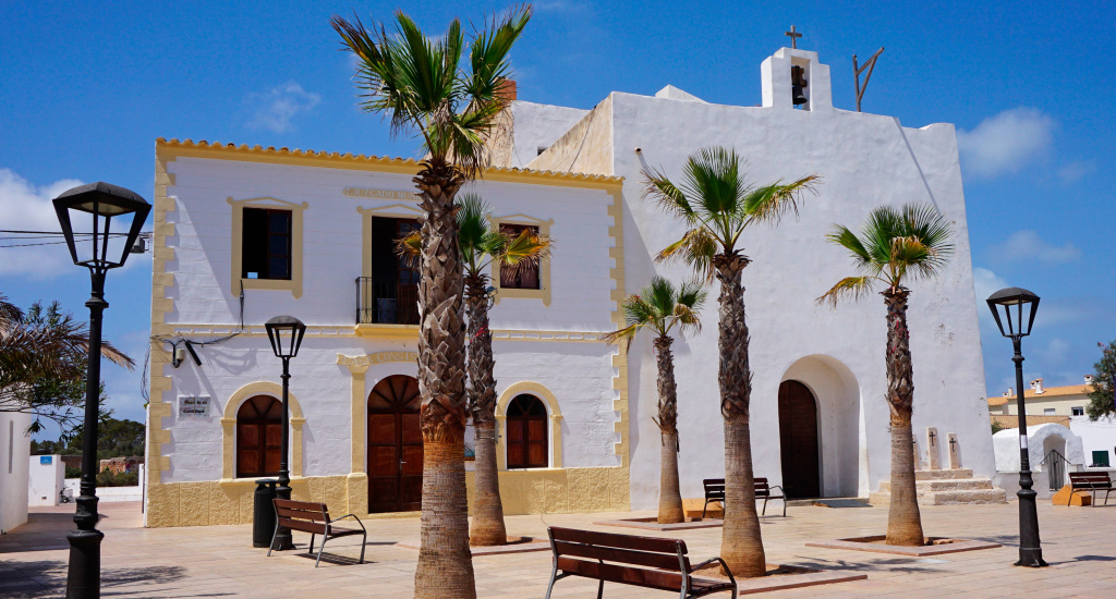 El pueblo de Sant Francesc, en Formentera.[/caption]

 X
X 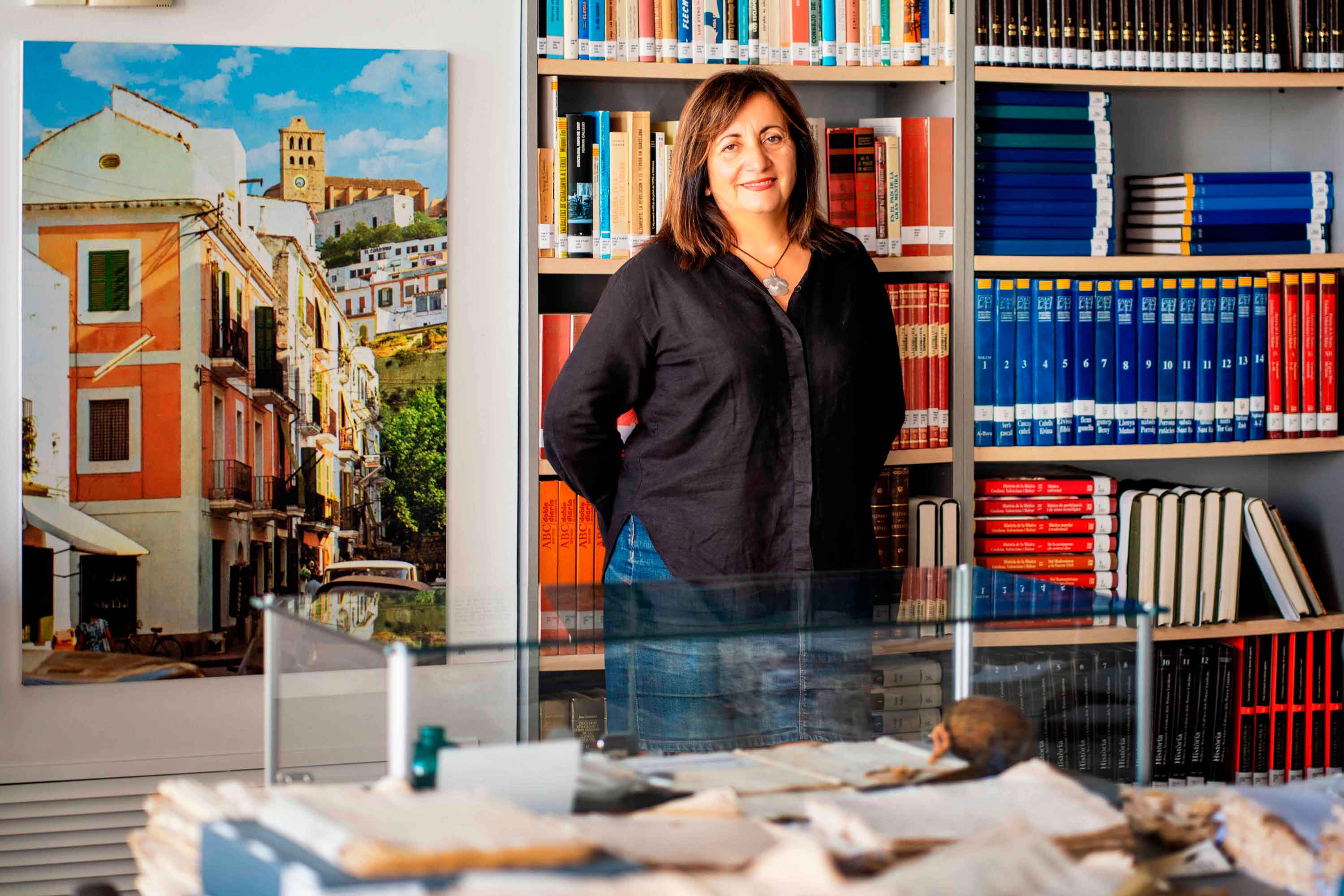
Historias del mar
Fanny Tur: «Baleària ya forma parte de la historia del transporte marítimo»
Ibicenca, activista medioambiental, historiadora, directora del archivo histórico de Eivissa… Fanny Tur Riera desempeñó, entre otros cargos públicos, el de consellera de Cultura del Govern Balear entre 2017 y 2019. Desde esta perspectiva, su análisis con visión histórica cobra valor: «Baleària ya forma parte de la historia del transporte marítimo de las Balears y del Mediterráneo», afirma antes de reflexionar sobre lo que supuso la irrupción de la naviera, ya que «los monopolios nunca son buenos y diversificar la oferta siempre tiene que beneficiar al usuario». En clave cultural y de género, esta historiadora destaca de la naviera Baleària cuestiones como «la atención en y al catalán, o poner nombres de mujer a algunos barcos, mostrando que la historia también la escribimos las mujeres». Desde la perspectiva ecologista, Tur Riera valora el compromiso de Baleària con la sostenibilidad partiendo de que «la actividad humana en general y el turismo y la gran movilidad en particular tienen unos efectos devastadores sobre el mar y el territorio». En este sentido, destaca, «todas las medidas que se pongan en práctica para minimizar los efectos de la masificación, como por ejemplo emplear energías renovables y colaborar con entidades ecologistas, ponen un grano de arena en una lucha que hace tiempo es imprescindible para la misma supervivencia». Pero si algo destaca de la aportación de Baleària esta exconsellera de Cultura del Govern Balear es el papel desempeñado por la Fundación Baleària, que ha hecho que «la creación pueda viajar a nuevos escenarios y no se quede en el lugar de origen. Para enriquecerse y crecer, el arte y la creación se tienen que mover mientras conservan sus raíces bien fuertes». Y ello, subraya, en combinación con la gestión de espacios culturales «en diferentes lugares —lo que desde la Fundación Baleària llaman las Llonges de la Cultura—, facilitando así que puedan acoger actividades, encuentros, investigación, muestras colectivas y creadores de todo el país para que se puedan encontrar y enriquecerse mutuamente» porque, reflexiona, «el arte y la investigación son trabajo propio, pero también son puesta en común y conocimiento mutuo». Creación cultural «En definitiva —asegura Fanny Tur— Baleària a través de su fundación ha hecho posible que la creación tenga movilidad, circule, se muestre en nuevos escenarios, porque así crece y encuentra nuevos paisajes… ha contribuido a la relación y el conocimiento mutuo entre creadores, facilitando que se encuentren, se conozcan y, en definitiva, que establezcanvínculos». En el caso de Balears, Fanny Tur considera que la de Baleària y de su fundación han sido una magnífica aportación favorecedora de la articulación social y cultural, además de subrayar la revitalización que ha supuesto la conexión, en todos los ámbitos, entre Dénia y Eivissa.
Read more

Historias del mar
De grumete a capitán. Vocabulario marítimo básico (I)
¿Dónde queda babor y estribor? ¿Cuál es la diferencia entre manga y eslora? Seguro que has oído una y mil veces términos como estos pero todavía te siguen generando dudas cuando subes a bordo de un ferri. No te preocupes, hemos preparado un glosario básico de léxico marítimo para que alimentes tu vocabulario y disfrutes todavía más de tu experiencia de viaje. Deja atrás tus titubeos de grumete y presume de hablar con la propiedad de un capitán. ¿Empezamos? PARTES DEL FERRI CASCO. El cuerpo del buque. La estructura ‘en neto’, sin máquinas, mástiles ni elementos accesorios para la navegación. CUBIERTA: Cada uno de los pisos de una embarcación. Forman la estructura que permiten un espacio habitable para la tripulación y el pasaje. Los barcos tienen varias cubiertas, tanto para la bodega -donde se ubica la carga y los vehículos- como para las zonas de pasajeros –con salones, áreas de butacas, restaurantes, etc.- siendo la principal la superior. QUILLA: Es la columna vertebral del barco. La pieza de hierro que va de popa a proa por la parte inferior del barco y en que se asienta toda su armazón.Constituye el principal refuerzo estructural de la embarcación, en el que se encastan los demás y sobre el que descargan su peso. [caption id="attachment_1776" align="aligncenter" width="800"] Corte transversal del ferri Martín i Soler de Baleària, donde se diferencia el casco, la quilla y las diferentes cubiertas.[/caption] VOLUMEN Y DIMENSIONES ESLORA: La longitud de la embarcación. O dicho de otra manera, la distancia de punta a punta de la estructura del buque. MANGA: La anchura (máxima) de un buque. PUNTAL. La altura de la bodega de la nave desde la quilla hasta el extremo de la cubierta superior. DESPLAZAMIENTO: El volumen de agua que desplaza la parte sumergida del barco. Es decir… el peso del barco. Ahora se entiende mejor ¿verdad?. POSICIÓN EN EL BARCO PROA y POPA. La proa es la parte delantera del barco. Tiene forma de cuña para que el buque pueda "cortar el agua”. Por el contrario, la popa es la parte posterior de la estructura del buque. BABOR y ESTRIBOR. Por babor se considera el lado izquierdo de un buque, mirando desde atrás hacia delante, esto es de popa a proa. Estribor es la banda o lado derecho de un buque, mirando desde atrás hacia delante, esto es de popa a proa. OBRA VIVA y MUERTA. La viva es la parte del casco bajo el agua. Es decir, desde la quilla a la línea de flotación a máxima carga. La muerta, la parte del casco que sobresale del mar MANIOBRAS ARRIAR. Aflojar o soltar un cabo (las cuerdas de a bordo). También se utilizan los términos LASCAR (aflojar) y LARGAR (soltar). Una advertencia: a bordo de los barcos sólo hay una cuerda, la del cronómetro. Las demás se llaman CABOS (y en los barcos grandes ESTACHAS). VIRAR. Lo contrario de arriar, es decir COBRAR o recuperar un cabo o el ancla, cuando el buque se encuentra fondeado. Por cierto, la maniobra de virar es propia de buques de vela y no tanto de ferris. ATRACAR. Operación para ubicar el buque en el lugar previsto del muelle. Concluye en el momento en que la embarcación AMARRA (o ata firmemente) el último cabo al NORAY o bolardo del muelle. Por cierto, la maniobra contraria a ATRACAR ser llama DESATRACAR. Lógico ¿no? BARLOVENTEAR. Maniobrar aprovechando la fuerza viento (a favor o en contra) para que el impulso sea lo más favorable a la embarcación. Por ejemplo, en el caso de una operación de atraque. CAPEAR. Se trata de una maniobra de navegación con mal tiempo. Consiste en tratar de mantener la proa al viento y con poca velocidad, para conseguir una trayectoria controlada y segura hasta que amaine el temporal. FONDEAR. Posicionar el buque en aguas establecidas para el anclaje. Y hasta aquí, por esta vez. Si quieres seguir aprendiendo sobre ferris y transporte marítimo, sigue navegando con el blog Entreolas y no te pierdas nuestra próxima entrega de vocabulario.
Read more